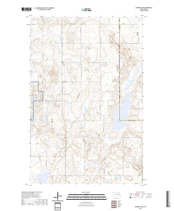
2024 Map of Johnson Lake
USGS Topo · Published 2024About this map
Johnson Lake National Wildlife Refuge anchors the eastern edge of this landscape, where the prairie of North Dakota transitions into a network of wetlands and conservation lands. The terrain is defined by the glacial depressions typical of the region, including Johnson Lake and Kelly Slough, which provide critical habitat within the Eddy County Waterfowl Production Area. This specific era of the plains is marked by a well-defined section line road grid, such as 92nd Ave NE and 23rd St NE, which facilitates access to the remote military installations at NG Camp Grafton. For genealogists and local historians, the Gethsemane Cem near the Nelson County line stands as a solitary marker of the area's early rural communities. The map highlights the intersection of public land management and agricultural boundaries in the township and range divisions of t149n r62w.
Find a feature on this map
27 named features on this map. Tap any name to fly to it.
Don’t see what you’re looking for? This feature index may not catch every label — zoom into the map to look around manually.
Map Details
Editions of this 2024 Johnson Lake Map
This is the sole edition of this map. No revisions or reprints were ever made.
Other maps of this area

1930 · Pekin
USGS Topo · 1:62,500

1930 · Hamar
USGS Topo · 1:62,500

1951 · Tolna
USGS Topo · 1:24,000

1951 · Pekin
USGS Topo · 1:62,500

1952 · New Rockford
USGS Topo · 1:250,000

1956 · New Rockford
USGS Topo · 1:250,000
1961 · Lake Coe
USGS Topo · 1:24,000

1961 · McHenry
USGS Topo · 1:24,000
1961 · Juanita
USGS Topo · 1:24,000

1961 · Johnson Lake
USGS Topo · 1:24,000