
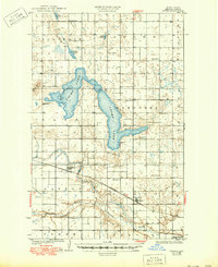
1930 Map of Pekin
USGS Topo · Published 1930About this map
Pekin and Tolna serve as the primary rail-oriented settlements in this 1927 survey, situated along the Great Northern railroad line in southern Nelson County. The landscape is dominated by the sprawling, irregular form of Stump Lake, including the dedicated Stump Lake Bird Refuge which highlights early conservation efforts in the region. The map captures a transition in North Dakota's transportation history, showing the co-existence of heavy rail and emerging automotive routes like State Highway No 1.
Find a feature on this map
24 named features on this map. Tap any name to fly to it.
Don’t see what you’re looking for? This feature index may not catch every label — zoom into the map to look around manually.
Map Details
Editions of this 1930 Pekin Map
2 editions found
Other maps of this area

1930 · Hamar
USGS Topo · 1:62,500

1942 · McVille
USGS Topo · 1:62,500

1950 · Devils Lake Mountain
USGS Topo · 1:24,000

1951 · Pekin NE
USGS Topo · 1:24,000

1951 · Devils Lake Mountain
USGS Topo · 1:24,000

1951 · Pekin NW
USGS Topo · 1:24,000

1951 · Tolna
USGS Topo · 1:24,000

1951 · Pekin
USGS Topo · 1:24,000

1951 · Pekin
USGS Topo · 1:62,500

1952 · New Rockford
USGS Topo · 1:250,000