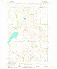
1961 Map of Juanita
USGS Topo · Published 1963About this map
The Great Northern railroad cuts across the prairie landscape of Foster County in the early 1960s, anchoring the small settlement of Juanita. This region of the Missouri River Basin is defined by a series of significant water bodies, including the prominent Juanita Lake and Cherry Lake, which dominate the central and northern sections of the map. Smaller features like Round Lake and the meandering Baldhill Creek reveal a glaciated terrain where numerous Gravel Pits indicate local surface mining activity.
Find a feature on this map
14 named features on this map. Tap any name to fly to it.
Don’t see what you’re looking for? This feature index may not catch every label — zoom into the map to look around manually.
Map Details
Editions of this 1961 Juanita Map
This is the sole edition of this map. No revisions or reprints were ever made.
Other maps of this area

1900 · Pingree
USGS Topo · 1:125,000

1944 · Brantford
USGS Topo · 1:62,500

1946 · Brantford
USGS Topo · 1:62,500

1949 · Grace City
USGS Topo · 1:24,000

1950 · Grace City
USGS Topo · 1:24,000

1950 · Brantford NE
USGS Topo · 1:24,000

1951 · Bordulac NE
USGS Topo · 1:24,000

1951 · Kensal NW
USGS Topo · 1:24,000

1951 · Glenfield
USGS Topo · 1:24,000

1952 · New Rockford
USGS Topo · 1:250,000