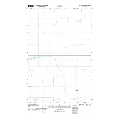
2011 Map of New Rockford NE
USGS Topo · Published 2011About this map
The James River snakes through this portion of Eddy County, defining the local geography northeast of New Rockford. A prominent water management feature, the New Rockford Number 2 Dam, controls the river's flow just east of the city's residential streets like Central Ave E. The landscape is predominantly organized by a strict township-and-range grid of gravel roads, including 23rd St NE and 73rd Ave NE, which partition the agricultural prairie into expansive plots. To the south, the settlement of Dundas sits near the riverbanks, while the waters of Schwoebel Slough mark the low-lying terrain. This 2011 survey captures the region's enduring rural character, where the interplay of hydraulic engineering and traditional Section Line roads continues to shape the North Dakota plains.
Find a feature on this map
20 named features on this map. Tap any name to fly to it.
Don’t see what you’re looking for? This feature index may not catch every label — zoom into the map to look around manually.
Map Details
Editions of this 2011 New Rockford NE Map
This is the sole edition of this map. No revisions or reprints were ever made.
Other maps of this area

1928 · Tokio
USGS Topo · 1:62,500

1931 · Oberon
USGS Topo · 1:62,500

1931 · Tokio
USGS Topo · 1:62,500

1944 · Brantford
USGS Topo · 1:62,500

1946 · Brantford
USGS Topo · 1:62,500

1948 · New Rockford
USGS Topo · 1:62,500

1950 · New Rockford
USGS Topo · 1:24,000

1950 · New Rockford NE
USGS Topo · 1:24,000

1950 · Oberon SW
USGS Topo · 1:24,000

1950 · Brantford NW
USGS Topo · 1:24,000