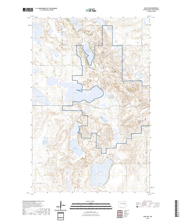
2024 Map of Lake Coe
USGS Topo · Published 2024About this map
The Eddy County Waterfowl Production Area dominates this landscape, preserving a complex of prairie potholes and wetlands essential for migratory birds. The terrain is defined by its glacial history, with a network of lakes including Lake Coe, Cherry Lake, and the connected North Washington Lake and South Washington Lake basins. This 2024 survey illustrates a highly rural environment where section-line roads like 21st St NE and Co Rd 8 provide the primary access to isolated farmsteads and conservation lands. A distinctive topographical rise known as Devils Thumb stands out against the low-lying lake beds, offering a rare point of elevation in a region otherwise characterized by subtle relief and water-filled depressions. The inclusion of NG Cam125 Grafton indicates a modern technical or monitoring presence in this quiet corner of the plains.
Find a feature on this map
21 named features on this map. Tap any name to fly to it.
Don’t see what you’re looking for? This feature index may not catch every label — zoom into the map to look around manually.
Map Details
Editions of this 2024 Lake Coe Map
This is the sole edition of this map. No revisions or reprints were ever made.
Other maps of this area

1928 · Tokio
USGS Topo · 1:62,500

1930 · Hamar
USGS Topo · 1:62,500

1931 · Tokio
USGS Topo · 1:62,500

1944 · Brantford
USGS Topo · 1:62,500

1946 · Brantford
USGS Topo · 1:62,500

1949 · Grace City
USGS Topo · 1:24,000

1950 · Grace City
USGS Topo · 1:24,000

1950 · Brantford NE
USGS Topo · 1:24,000
1951 · Horseshoe Lake
USGS Topo · 1:24,000
1951 · Tokio
USGS Topo · 1:62,500