
1961 Map of Revere
USGS Topo · Published 1963About this map
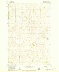
The Great Northern railroad cuts a diagonal line across the prairie landscape of Griggs County, serving the small settlement of Revere. This early 1960s survey, conducted for the development of the Missouri River Basin, illustrates a rural economy defined by township boundaries like Helena, Dover, and Bartley. The map reveals the social infrastructure of the time, including School No 2 and the Eidfjord Ch, which stands near a small Cem in the southern portion of the quadrangle. Significant hydrological features such as Baldhill Creek dominate the northern terrain, where a notable Spillway Elev 1392 is documented. Scattered across the landscape are several Gravel Pits, indicating the local extraction and infrastructure needs of this agrarian region during the mid-twentieth century.
Find a feature on this map
11 named features on this map. Tap any name to fly to it.
Don’t see what you’re looking for? This feature index may not catch every label — zoom into the map to look around manually.
Map Details
Editions of this 1961 Revere Map
This is the sole edition of this map. No revisions or reprints were ever made.
Other maps of this area

1952 · New Rockford
USGS Topo · 1:250,000

1956 · New Rockford
USGS Topo · 1:250,000

1961 · Sutton
USGS Topo · 1:24,000

1961 · Wimbledon
USGS Topo · 1:24,000

1961 · Hannaford
USGS Topo · 1:24,000

1961 · Wimbledon NE
USGS Topo · 1:24,000

1961 · Cooperstown West
USGS Topo · 1:24,000

1961 · Sutton NE
USGS Topo · 1:24,000
1961 · Sutton SW
USGS Topo · 1:24,000

1961 · Dazey
USGS Topo · 1:24,000