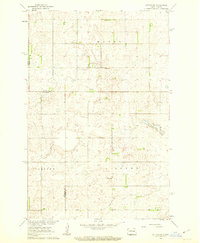
1961 Map of Sutton SW
USGS Topo · Published 1963About this map
Mabel, Dover, and Corinne townships meet at the intersection of Griggs, Foster, and Stutsman counties, defining this stretch of the North Dakota prairie in the early 1960s. The landscape is characterized by its agricultural organization, with fine red dashed lines indicating the extensive network of fence and field lines that structured the rural economy during this period of development in the Missouri River Basin.
Find a feature on this map
11 named features on this map. Tap any name to fly to it.
Don’t see what you’re looking for? This feature index may not catch every label — zoom into the map to look around manually.
Map Details
Editions of this 1961 Sutton SW Map
This is the sole edition of this map. No revisions or reprints were ever made.
Other maps of this area

1900 · Pingree
USGS Topo · 1:125,000

1951 · Courtenay
USGS Topo · 1:24,000

1951 · Kensal SE
USGS Topo · 1:24,000

1951 · Glenfield
USGS Topo · 1:24,000

1952 · New Rockford
USGS Topo · 1:250,000

1956 · New Rockford
USGS Topo · 1:250,000

1961 · Sutton
USGS Topo · 1:24,000

1961 · Revere
USGS Topo · 1:24,000

1961 · Wimbledon
USGS Topo · 1:24,000

1961 · Wimbledon NE
USGS Topo · 1:24,000