
1961 Map of Kloten NW
USGS Topo · Published 1963About this map
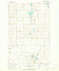
The Sheyenne River meanders deeply through a sharp valley at the northern edge of the Nelson and Griggs county line. This early 1960s survey documents a transition in the prairie landscape, where the wooded river breaks contrast with the gridded section lines of the surrounding agricultural uplands. Settlement patterns are sparse, anchored by local community landmarks such as Norway Ch and the New Luther Valley Cem. The topography is dominated in the south by the broad rise of Pilot Mound, while the McVille Coulee feeds into the main river system from the north. Scattered glacial potholes and small wetlands are visible throughout the southern sections, illustrating the classic drainage patterns of the eastern North Dakota plains before modern agricultural tiling significantly altered the surface water.
Find a feature on this map
9 named features on this map. Tap any name to fly to it.
Don’t see what you’re looking for? This feature index may not catch every label — zoom into the map to look around manually.
Map Details
Editions of this 1961 Kloten NW Map
This is the sole edition of this map. No revisions or reprints were ever made.
Other maps of this area

1930 · Pekin
USGS Topo · 1:62,500

1942 · McVille
USGS Topo · 1:62,500

1951 · Pekin
USGS Topo · 1:24,000

1951 · Pekin
USGS Topo · 1:62,500

1952 · New Rockford
USGS Topo · 1:250,000

1956 · New Rockford
USGS Topo · 1:250,000

1961 · Binford
USGS Topo · 1:24,000

1961 · Jessie
USGS Topo · 1:24,000

1961 · Binford NE
USGS Topo · 1:24,000
1961 · McVille
USGS Topo · 1:24,000