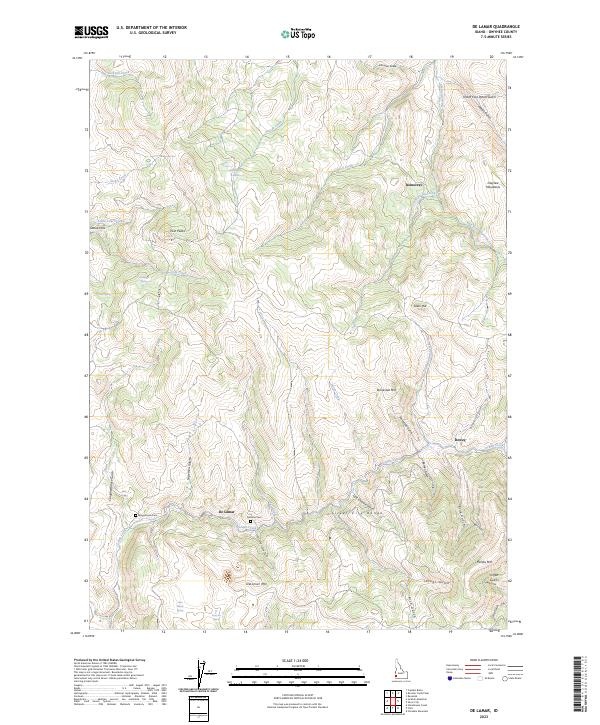
2023 Map of De Lamar
USGS Topo · Published 2023About this map
The rugged mining districts of the Owyhee Mountains define this landscape, where the settlement of De Lamar serves as a central point along Jordan Creek. This survey captures the historical footprint of the region's late-19th-century silver boom, centered around the Silver City Range and significant peaks such as Florida Mtn and DeLamar Mtn. The topography is etched with deep drainages including Rich Gulch, China Gulch, and Slaughterhouse Gulch, reflecting the intense resource extraction history of the area. For genealogists and local historians, the map identifies specific burial sites like Wagontown Cem and Delamar Cem, located near the winding path of Silver City Rd. Smaller mining-era sites such as Dewey and Democrat further illustrate the distribution of early Idaho high-country camps. The landscape is also marked by numerous natural water sources, from the Johnston Lakes in the north to isolated springs like Deaf Joe Spring and Willinger Spring.
Find a feature on this map
54 named features on this map. Tap any name to fly to it.
Don’t see what you’re looking for? This feature index may not catch every label — zoom into the map to look around manually.
Map Details
Editions of this 2023 De Lamar Map
This is the sole edition of this map. No revisions or reprints were ever made.
Other maps of this area

1892 · Silver City
USGS Topo · 1:125,000

1894 · Silver City
USGS Topo · 1:125,000

1898 · Silver City
USGS Topo · 1:125,000

1955 · Jordan Valley
USGS Topo · 1:250,000

1955 · Boise
USGS Topo · 1:250,000

1957 · Jordan Valley
USGS Topo · 1:250,000

1958 · Boise
USGS Topo · 1:250,000

1958 · Jordan Valley
USGS Topo · 1:250,000

1962 · Boise
USGS Topo · 1:250,000

1965 · Triangle
USGS Topo · 1:62,500