2022 Map of De Mossville
USGS Topo · Published 2022About this map
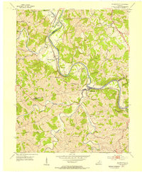
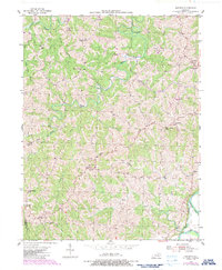
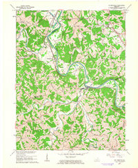
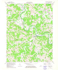
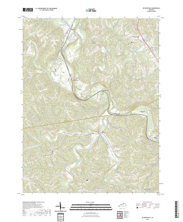
The Licking River carves a winding path through this portion of Northern Kentucky, where the border between Kenton, Campbell, and Pendleton Counties meets. This 2022 survey captures the long-standing agricultural and riverine character of the region, anchored by the Licking Valley RR which parallels the water through Morning View and DeMossville. The landscape is defined by its ridge-and-hollow topography, with named elevations like Pleasant Ridge and Clay Ridge overlooking fertile basins such as Wilmington Bottom. Local family history is well-represented through several small burial grounds including Smith Cem and Caldwell Cem, alongside the Grassy Creek Church Cem. The settlement pattern follows the drainage of the North Fork Grassy Creek and South Fork Grassy Creek, reflecting generations of rural development along these waterways and historic thoroughfares like DeCoursey Pike.
Find a feature on this map
104 named features on this map. Tap any name to fly to it.
Don’t see what you’re looking for? This feature index may not catch every label — zoom into the map to look around manually.
Map Details
Editions of this 2022 De Mossville Map
This is the sole edition of this map. No revisions or reprints were ever made.
Historical Maps of Caldwell Through Time
6 maps found