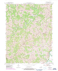
1953 Map of Goforth
USGS Topo · Published 1987About this map
Portland and the small crossroads of Goforth anchor this rural landscape in the hills above the South Fork Licking River. The terrain is defined by a dense network of winding waterways, including the Middle Fork Grassy Creek and Fishing Creek, which carve deep valleys between high points like Fairview Ridge. This 1953 field-checked survey reveals a community organized around family-named landmarks and local institutions, evidenced by the numerous country churches and small schools such as Portland Sch and Short Creek Ch. A distinctive late-century addition, the Gene Snyder Airport, appears near the eastern border, reflecting a shift in local infrastructure. Genealogists will find significant value in the documentation of scattered burial grounds like McMillan Cem and St Johns Cem, which sit alongside established congregations at Unity Ch and Pleasant Ridge Ch.
Find a feature on this map
36 named features on this map. Tap any name to fly to it.
Don’t see what you’re looking for? This feature index may not catch every label — zoom into the map to look around manually.
Map Details
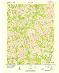
Editions of this 1953 Goforth Map
2 editions found
Other maps of this area

1929 · Alexandria
USGS Topo · 1:48,000

1930 · Falmouth
USGS Topo · 1:48,000

1936 · Alexandria
USGS Topo · 1:62,500

1936 · Falmouth
USGS Topo · 1:62,500

1950 · Mason
USGS Topo · 1:24,000

1950 · Williamstown
USGS Topo · 1:24,000

1950 · Walton
USGS Topo · 1:24,000

1953 · Berry
USGS Topo · 1:24,000

1953 · Kelat
USGS Topo · 1:24,000

1953 · Butler
USGS Topo · 1:24,000