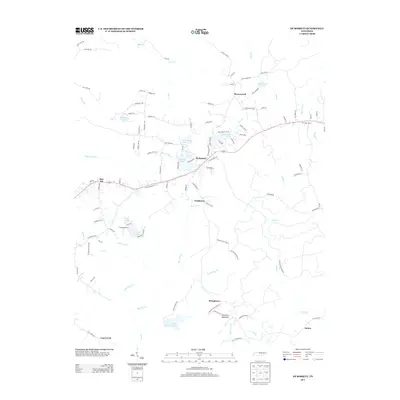
2013 Map of De Rossett
USGS Topo · Published 2013About this map
Ravenscroft and Bon Air anchor this survey of the Cumberland Plateau, showing a landscape defined by small settlements and complex hydrology. The presence of Old Highway 70 crossing the central terrain highlights the historical transportation corridor between De Rossett and Clarktown. The area is characterized by numerous small reservoirs such as Wonder Lake, Arrowhead Lake, and Buck Creek Lake, alongside specialized sites like Camp Belle Aire. Topographical features such as Chestnut Mountain and the deep incisions of Big Lost Cr and Clifty Cr dictate the layout of rural routes like Randolph Rd and Cove Rd. Farther south, the smaller communities of Stringtown and Mobra sit near the headwaters of Big Laurel Cr, representing the quiet, dispersed nature of this Tennessee highland region.
Find a feature on this map
107 named features on this map. Tap any name to fly to it.
Don’t see what you’re looking for? This feature index may not catch every label — zoom into the map to look around manually.
Map Details
Editions of this 2013 De Rossett Map
This is the sole edition of this map. No revisions or reprints were ever made.
Other maps of this area

1892 · Pikeville
USGS Topo · 1:125,000

1895 · Pikeville
USGS Topo · 1:125,000

1897 · Standingstone
USGS Topo · 1:125,000

1898 · Standingstone
USGS Topo · 1:125,000

1912 · Crossville
USGS Topo · 1:62,500

1935 · Campbell Junction
USGS Topo · 1:24,000

1943 · Cookeville
USGS Topo · 1:100,000

1944 · Cookeville
USGS Topo · 1:100,000

1946 · Campbell Junction
USGS Topo · 1:24,000
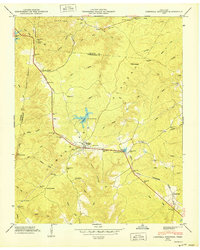
1950 · Campbell Junction
USGS Topo · 1:24,000