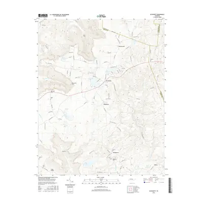
2016 Map of De Rossett
USGS Topo · Published 2016About this map
The plateau landscape of White County near the Cumberland County line is defined by a sequence of upland communities and deep drainage coves. Settlements like Bon Air and Ravenscroft represent the historical footprint of mining and timber activity in the region, while newer residential loops have developed around Arrowhead Lake and Doe Creek Lake. The terrain is deeply incised by watercourses such as Blue Spring Cr and Big Lost Cr, which carve out significant natural depressions like Blue Spring Cove and Dog Cove. These coves often hold the oldest signs of habitation, including the isolated Lost Creek Cem and Anderson Cem. In the southern portion of the map, the landscape transitions toward Chestnut Mtn, with smaller clusters like Stringtown and Mobra positioned along the ridges. The concentration of family and community cemeteries scattered through the hills provides a clear roadmap for genealogical research into this part of the Cumberland Plateau.
Find a feature on this map
99 named features on this map. Tap any name to fly to it.
Don’t see what you’re looking for? This feature index may not catch every label — zoom into the map to look around manually.
Map Details
Editions of this 2016 De Rossett Map
This is the sole edition of this map. No revisions or reprints were ever made.
Other maps of this area

1892 · Pikeville
USGS Topo · 1:125,000

1895 · Pikeville
USGS Topo · 1:125,000

1897 · Standingstone
USGS Topo · 1:125,000

1898 · Standingstone
USGS Topo · 1:125,000

1912 · Crossville
USGS Topo · 1:62,500

1935 · Campbell Junction
USGS Topo · 1:24,000

1943 · Cookeville
USGS Topo · 1:100,000

1944 · Cookeville
USGS Topo · 1:100,000

1946 · Campbell Junction
USGS Topo · 1:24,000
1950 · Campbell Junction
USGS Topo · 1:24,000