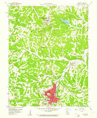
1960 Map of De Soto
USGS Topo · Published 1961About this map
De Soto and the surrounding Jefferson County hillsides appear here during a period of established growth along the Missouri Pacific railroad. The town center is densely plotted with landmarks such as Ritcher Park, Spross Park, and the High School, while the southern outskirts are anchored by the campus of Mt St Clements College. The landscape is defined by the winding course of Joachim Creek and a network of valleys including Shepley Hollow and Butcher Branch. Evidence of mid-century community life is visible in the Drive-in Theater along the highway and the residential development surrounding Lake Wauwanoka to the northeast. Local history is deeply etched into the terrain through numerous small cemeteries and rural congregations like Luckey Ch and Oak Ridge Ch, reflecting the scattered settlement patterns of the Central and Valle townships.
Find a feature on this map
41 named features on this map. Tap any name to fly to it.
Don’t see what you’re looking for? This feature index may not catch every label — zoom into the map to look around manually.
Map Details
Editions of this 1960 De Soto Map
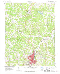
2 editions found
Other maps of this area

1901 · De Soto
USGS Topo · 1:125,000

1912 · Kimmswick
USGS Topo · 1:62,500

1915 · Crystal City
USGS Topo · 1:62,500

1916 · Kimmswick
USGS Topo · 1:62,500

1930 · De Soto NE
USGS Topo · 1:24,000

1930 · Pacific SE
USGS Topo · 1:24,000

1931 · De Soto SE
USGS Topo · 1:24,000

1937 · Fletcher
USGS Topo · 1:24,000

1937 · Tiff
USGS Topo · 1:24,000

1938 · Cedar Hill
USGS Topo · 1:24,000
Featured Places
- De Soto, Valle Township
- Hillsboro, Central Township
- Valle Township, MO
- Central Township, MO
- Victoria, Central Township