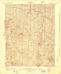
1931 Map of De Soto SE
USGS Topo · Published 1931About this map
The Big River carves a deep path across this corner of Jefferson and St. Francois counties, anchoring a landscape where rural education and religious life were tied to the winding hollows. In the early 1930s, the region was defined by a high density of local schools such as Mothershead Sch, Prospect Sch, and Moontown Sch, which served the scattered residents of Vineland and Blackwell. These small institutions, along with Mt Olive Ch and the Joachim Cem, suggest a community structure based on small, independent farmsteads before modern consolidation.
Find a feature on this map
26 named features on this map. Tap any name to fly to it.
Don’t see what you’re looking for? This feature index may not catch every label — zoom into the map to look around manually.
Map Details
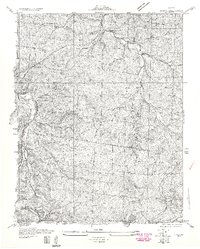
Editions of this 1931 De Soto SE Map
2 editions found
Other maps of this area

1901 · De Soto
USGS Topo · 1:125,000

1904 · Farmington
USGS Topo · 1:62,500

1905 · Bonneterre
USGS Topo · 1:62,500

1906 · Farmington
USGS Topo · 1:62,500

1915 · Crystal City
USGS Topo · 1:62,500

1930 · De Soto NE
USGS Topo · 1:24,000
1931 · De Soto SE
USGS Topo · 1:24,000
1937 · Fletcher
USGS Topo · 1:24,000
1937 · Tiff
USGS Topo · 1:24,000

1938 · Fletcher
USGS Topo · 1:24,000