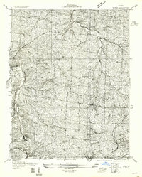
1955 Map of De Soto SE
USGS Topo · Published 1955About this map
The Jefferson Co St Francois Co boundary line bisects this 1930s landscape, where rural communities like Vineland and Blackwell are defined by their proximity to the Missouri Pacific railroad. The mapping, which was compiled in part from Air Corps aerial photography, reveals a dense network of country schools that served isolated ridge and valley homesteads, including Mothershead Sch, Dripping Spring Sch, and McGehan Sch. In the southern reaches of the quadrangle, the St Francois County Railroad follows the path of the St Francois River, serving the small settlement of Melzo. The terrain is deeply dissected by the Big River and Joachim Creek, where family histories are recorded at the Joachim Cem and Vineyard Cem. Significant transportation infrastructure is visible at the Tunnel Sta and Silver Springs Sta, highlighting the importance of rail transit before the dominance of the Old State Highway.
Find a feature on this map
25 named features on this map. Tap any name to fly to it.
Don’t see what you’re looking for? This feature index may not catch every label — zoom into the map to look around manually.
Map Details
Editions of this 1955 De Soto SE Map
This is the sole edition of this map. No revisions or reprints were ever made.
Other maps of this area

1901 · De Soto
USGS Topo · 1:125,000

1904 · Farmington
USGS Topo · 1:62,500

1905 · Bonneterre
USGS Topo · 1:62,500

1906 · Farmington
USGS Topo · 1:62,500

1915 · Crystal City
USGS Topo · 1:62,500

1930 · De Soto NE
USGS Topo · 1:24,000

1931 · De Soto SE
USGS Topo · 1:24,000

1937 · Fletcher
USGS Topo · 1:24,000

1937 · Tiff
USGS Topo · 1:24,000

1938 · Fletcher
USGS Topo · 1:24,000