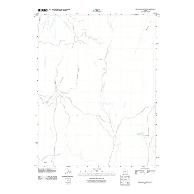
2011 Map of Deadman Canyon
USGS Topo · Published 2011About this map
Knight-Ideal Mine sits nestled in the drainages east of Deadman Canyon, marking the industrial footprint on this high desert terrain in Carbon County. The landscape is defined by its complex hydrology and transportation routes, including Coal-Airport Cutoff Rd which links the highlands to the Carbon County Airport in the south. High plateaus such as Emma Park and Whitmore Park provide geographic relief above the many branching forks of Deadman Creek and Coal Creek. To the east, Andersons Reservoir and E Andersons Dam indicate localized water management in an area otherwise characterized by ephemeral washes like Hayes Wash and the steep passage through Cave Pass.
Find a feature on this map
42 named features on this map. Tap any name to fly to it.
Don’t see what you’re looking for? This feature index may not catch every label — zoom into the map to look around manually.
Map Details
Editions of this 2011 Deadman Canyon Map
This is the sole edition of this map. No revisions or reprints were ever made.
Other maps of this area

1886 · Price River
USGS Topo · 1:250,000

1896 · Price River
USGS Topo · 1:250,000

1914 · Castle Gate
USGS Topo · 1:62,500

1915 · Wellington
USGS Topo · 1:62,500

1916 · Castle Gate
USGS Topo · 1:62,500

1956 · Price
USGS Topo · 1:250,000

1960 · Price
USGS Topo · 1:250,000

1962 · Price
USGS Topo · 1:250,000
1969 · Minnie Maud Creek East
USGS Topo · 1:24,000
1969 · Minnie Maud Creek West
USGS Topo · 1:24,000