
1915 Map of Wellington
USGS Topo · Published 1915About this map
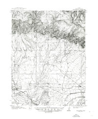
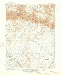
The Book Cliffs dominate the northern landscape of this Carbon County region, dropping sharply into the wide expanses of Clark Valley. Surveyed between 1912 and 1914, the map reveals a rugged terrain where water sources like Whitmore Spring and various creeks are the primary drivers of settlement. The Price River flows through the southwest corner, providing a corridor for the Wellington township and the Denver and Rio Grande railroad. This intersection of rail and river made Wellington a focal point for local commerce and transport before the mid-century. Away from the town, the land is marked by isolated outposts such as Edwards Ranch and Youngs Ranch, illustrating a dispersed ranching economy. The presence of the Sunnyside Branch railroad line indicates the early industrial importance of the surrounding coal-rich canyons during this era.
Find a feature on this map
34 named features on this map. Tap any name to fly to it.
Don’t see what you’re looking for? This feature index may not catch every label — zoom into the map to look around manually.
Map Details
Editions of this 1915 Wellington Map
3 editions found
Other maps of this area

1886 · Price River
USGS Topo · 1:250,000

1896 · Price River
USGS Topo · 1:250,000

1914 · Castle Gate
USGS Topo · 1:62,500

1915 · Sunnyside
USGS Topo · 1:62,500

1916 · Castle Gate
USGS Topo · 1:62,500

1948 · Woodside
USGS Topo · 1:62,500

1949 · Woodside
USGS Topo · 1:62,500

1950 · Woodside
USGS Topo · 1:62,500

1956 · Price
USGS Topo · 1:250,000

1960 · Price
USGS Topo · 1:250,000