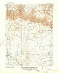
1915 Map of Wellington
USGS Topo · Published 1948About this map
Wellington serves as the primary settlement on this survey of Carbon County, situated at the junction where the Denver and Rio Grande Western railroad meets the Price River. The map captures a high-desert landscape defined by the dramatic escarpment of the Book Cliffs, which separates the high plateaus of Emma Park from the broad expanse of Clark Valley. To the south, the Midland Trail provides a clear view of early transcontinental travel routes through the region, following the path of the railroad and the Sunnyside Branch line.
Find a feature on this map
33 named features on this map. Tap any name to fly to it.
Don’t see what you’re looking for? This feature index may not catch every label — zoom into the map to look around manually.
Map Details
Editions of this 1915 Wellington Map
3 editions found
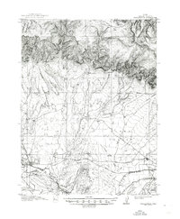
Other maps of this area

1886 · Price River
USGS Topo · 1:250,000

1896 · Price River
USGS Topo · 1:250,000

1914 · Castle Gate
USGS Topo · 1:62,500

1915 · Sunnyside
USGS Topo · 1:62,500

1915 · Wellington
USGS Topo · 1:62,500

1916 · Castle Gate
USGS Topo · 1:62,500

1948 · Woodside
USGS Topo · 1:62,500

1949 · Woodside
USGS Topo · 1:62,500

1950 · Woodside
USGS Topo · 1:62,500

1956 · Price
USGS Topo · 1:250,000