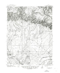
1915 Map of Wellington
USGS Topo · Published 1948About this map
The Denver and Rio Grande railroad serves as the primary artery through this Carbon County landscape, following the path of the Price River as it winds past the settlement of Wellington. This era reflects the early 20th-century expansion of the coal and ranching economy in Utah, where the Sunnyside Branch splits off toward industrial operations while the Midland Trail provides a key overland route for early motorists. To the north, the terrain transitions from the broad expanse of Clark Valley into the high country of Emma Park. This map identifies critical family landmarks and watering holes essential for high-desert survival and commerce, including the Edwards Ranch, Youngs Ranch, and Whitmore Spring. Smaller outposts like Farnham and Miller mark the rail stops and ranching nodes that once defined this arid region before modern development.
Find a feature on this map
27 named features on this map. Tap any name to fly to it.
Don’t see what you’re looking for? This feature index may not catch every label — zoom into the map to look around manually.
Map Details
Editions of this 1915 Wellington Map
3 editions found
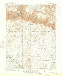
Other maps of this area

1886 · Price River
USGS Topo · 1:250,000

1896 · Price River
USGS Topo · 1:250,000

1914 · Castle Gate
USGS Topo · 1:62,500

1915 · Sunnyside
USGS Topo · 1:62,500

1915 · Wellington
USGS Topo · 1:62,500

1916 · Castle Gate
USGS Topo · 1:62,500

1948 · Woodside
USGS Topo · 1:62,500

1949 · Woodside
USGS Topo · 1:62,500

1950 · Woodside
USGS Topo · 1:62,500

1956 · Price
USGS Topo · 1:250,000