
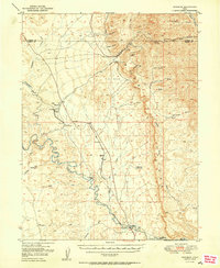
1950 Map of Woodside
USGS Topo · Published 1950About this map
Woodside stands at the southern edge of this mid-century landscape, positioned where the Denver and Rio Grande Western railroad crosses the winding Price River. The map documents a rugged high-desert economy defined by isolated outposts and industrial extraction, most notably at the Geneva Coal Mine nestled within Horse Canyon. To the west, the topography transitions from the dramatic cliffs of The Cove to a series of dry washes such as Humbug Wash and Neversweat Wash.
Find a feature on this map
41 named features on this map. Tap any name to fly to it.
Don’t see what you’re looking for? This feature index may not catch every label — zoom into the map to look around manually.
Map Details
Editions of this 1950 Woodside Map
2 editions found
Other maps of this area

1886 · Price River
USGS Topo · 1:250,000

1896 · Price River
USGS Topo · 1:250,000

1915 · Sunnyside
USGS Topo · 1:62,500

1915 · Wellington
USGS Topo · 1:62,500

1948 · Woodside
USGS Topo · 1:62,500

1949 · Woodside
USGS Topo · 1:62,500

1954 · Flat Canyon
USGS Topo · 1:62,500

1954 · Range Creek
USGS Topo · 1:62,500

1956 · Price
USGS Topo · 1:250,000

1960 · Price
USGS Topo · 1:250,000