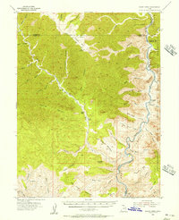
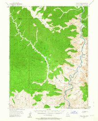
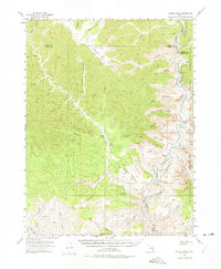
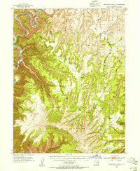
1954 Map of Range Creek
USGS Topo · Published 1956About this map
Range Creek carves a deep valley through the high plateaus of Emery and Carbon counties, serving as a vital corridor in this mid-century survey of eastern Utah. Isolated outposts such as Pilling Ranch and Wilcox Ranch are connected only by a network of jeep trails, illustrating the extreme isolation of the landscape before modern infrastructure. The Green River forms a massive eastern boundary, winding through the iconic Desolation Canyon and Gray Canyon. This waterway separates the rugged benches from the Uintah and Ouray Indian Reservation and Uncompahgre Indian Reservation to the east. Distinctive landmarks like Xmas Mtn and Valley Mtn tower over a complex system of side canyons including Turtle Canyon and Lighthouse Canyon, while a solitary Coal deposit near the southern river bend hints at the region's geologic and industrial potential.
Find a feature on this map
56 named features on this map. Tap any name to fly to it.
Don’t see what you’re looking for? This feature index may not catch every label — zoom into the map to look around manually.
Map Details
Editions of this 1954 Range Creek Map
3 editions found
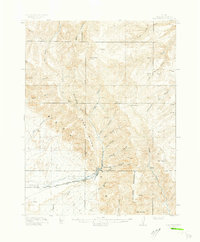
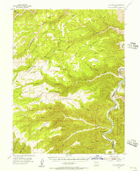
Other maps of this area

1885 · East Tavaputs
USGS Topo · 1:250,000

1886 · Price River
USGS Topo · 1:250,000

1896 · Price River
USGS Topo · 1:250,000
1915 · Sunnyside
USGS Topo · 1:62,500

1948 · Woodside
USGS Topo · 1:62,500

1949 · Woodside
USGS Topo · 1:62,500

1950 · Woodside
USGS Topo · 1:62,500
1953 · Firewater Canyon
USGS Topo · 1:62,500
1954 · Flat Canyon
USGS Topo · 1:62,500

1956 · Price
USGS Topo · 1:250,000