Old Maps of Grand County, Utah
Explore 607 old maps of Grand County, spanning from 1885 to today. These high-resolution historic maps reveal how streets, neighborhoods, landmarks, and natural features evolved over time — perfect for genealogy, metal detecting, research, and local history exploration.
What you can do with these maps:
- See how Grand County changed over time: Compare historical maps to modern-day views to trace roads, homesites, rail lines & more.
- View detailed metadata: Each map includes creators, publishers, year, scale, and archive source.
- Overlay maps with satellite & LiDAR: Visualize the past alongside modern tools to explore terrain & human change.
- Trusted historical sources: Maps sourced from the USGS, Library of Congress, and other archives.
- Access maps your way: View online, download high-res files, or order prints for personal or research use.
Start exploring old maps of Grand County to uncover forgotten places, hidden landmarks, and the deep history beneath your feet.
Grand County, UT maps
(607)- 1885 Map of San Rafael
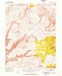
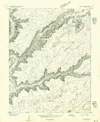
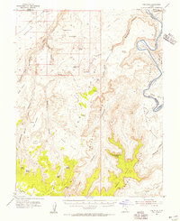
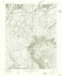
 1885 San Rafael1885 Print · USGSCentral Utah at the height of the Powell Survey reveals a land defined by water and stone. Genealogists and historians can locate early settlements like Tidwell and Blake or trace the intricate river systems of Labyrinth Canyon and San Rafael Valley.5 unique versions available
 - 1885 Map of East Tavaputs
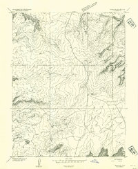
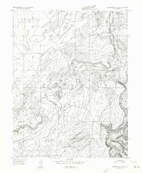
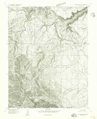
 1885 East Tavaputs1885 Print · USGSEastern Utah in the mid-1880s was a landscape of massive plateaus and vital rail corridors. Researchers can trace the path of the Denver and Rio Grande Western through the Grand River Valley or locate water sources like Asphalt Creek and Bitter Water Creek.6 unique versions available
 - 1885 Map of La Sal
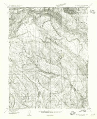
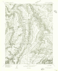
 1885 La Sal1885 Print · USGSSoutheast Utah in the mid-1880s remains a frontier of dramatic river canyons and high mountain peaks. Genealogists and historians can trace the early footprints of Moab and Plainfield or locate the high summits of Mt Peale and the path of the Green River.6 unique versions available
 - 1886 Map of Price River
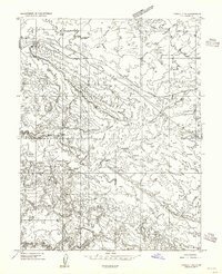
 1886 Price River1886 Print · USGSEmery County and the surrounding canyonlands are documented here just as the railroad arrived in the mid-1880s. Local researchers can trace the early path of the Denver and Rio Grande Western R. R. through Castle Gate, Price, and Sunny Side.4 unique versions available
 - 1896 Map of Price River
 1896 Price River1896 Print · USGSEmery County was transitioning into a vital rail corridor during the late nineteenth century. Trace the early layout of Price and Castle Dale alongside the winding Denver and Rio Grande Western RR and the depths of Desolation Canyon.
 - 1951 Map of The Knoll, 1953 Print
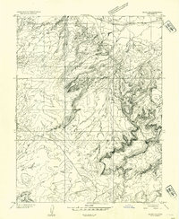
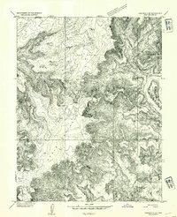
 1951 The Knoll1953 Print · USGSThe Grand and San Juan County line at the dawn of the 1950s is a landscape of remote cattle ranges and deep river canyons. Researchers can trace the era's ranching infrastructure through Dubinky Well, Gil Well, and the grazing lands of Arth Pasture.5 unique versions available
 - 1951 Map of Upheaval Dome, 1955 Print
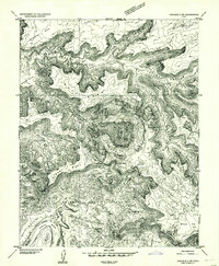
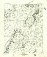
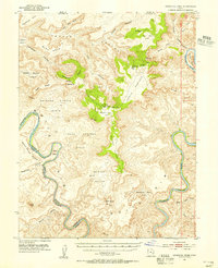 1951 Upheaval Dome1955 Print · USGSThe confluence region of the Green and Colorado Rivers is captured here in the early 1950s, documenting a remote wilderness of canyons and high mesas. Researchers can locate ancient Cliff Dwellings near Aztec Butte or trace the intricate river bends at Turks Head and Goose Neck.3 unique versions available
 - 1952 Map of Moab 4 NW
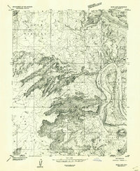
 1952 Moab 4 NW1952 Print · USGSGrand County, Utah, is shown in the early 1950s as a landscape of remote pastures and vital desert water sources. Local history researchers can trace the locations of Dalton Well, Lower Courthouse Spring, and mineral sites near Moab Canyon.
 - 1952 Map of Tidwell 4 SE, 1954 Print
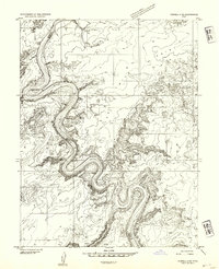
 1952 Tidwell 4 SE1954 Print · USGSThe Green River serpentine loops dominate this mid-century desert landscape at the meeting point of four Utah counties. Trace the river's path through the iconic Bowknot Bend and locate historic access points like Mineral Bottom and Horse Thief Bottom along the canyon floor.
 - 1952 Map of Moab 3 NE, 1954 Print
 1952 Moab 3 NE1954 Print · USGSGrand County, Utah, is captured in the early fifties during a period of transition in Western cartography. Researchers can trace the rugged drainages of Bartlett Wash and Mill Canyon, or locate landmarks like Jug Rock and Brink Spring.
 - 1952 Map of Carlisle 2 NW, 1954 Print
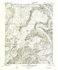
 1952 Carlisle 2 NW1954 Print · USGSSoutheast Utah's high plateau and canyon country are captured in the early 1950s, showing the dramatic geologic relief of the Green River corridor. Trace the isolation of the Upheaval Dome and the remote river flats at Valentine Bottom and Upheaval Bottom.
 - 1952 Map of Moab 3 SE, 1954 Print
 1952 Moab 3 SE1954 Print · USGSThe high plateau of Grand County, Utah, is captured here in the early fifties as ranching and oil exploration began to mark the landscape. Researchers can trace the early cattle and water infrastructure at Big Flat Res, Arth Pasture, and the Little Valley Barn.
 - 1952 Map of Carlisle 2 NE, 1954 Print
 1952 Carlisle 2 NE1954 Print · USGSSan Juan County in the early fifties shows a wild canyon landscape along the Colorado River before the rise of modern tourism. Researchers can trace historic land use through isolated Cabin sites and significant landmarks like the Cliff Dwelling and Aztec Butte.
 - 1952 Map of Tidwell 4 NE, 1954 Print
 1952 Tidwell 4 NE1954 Print · USGSThe canyons of the Green River dominate this early 1950s survey of the Utah high desert. Historians and geologists can trace the winding county boundary and locate remote water sources like Keg Spring and Spring Canyon.
 - 1952 Map of Moab 3 SW, 1954 Print
 1952 Moab 3 SW1954 Print · USGSThe Green River backcountry of eastern Utah is captured here in the early fifties, showing a landscape of sheer cliffs and isolated river bottoms. Trace the rugged terrain of Mineral Canyon and find remote water sources like Horsethief Spring and the Green River flats.
 - 1952 Map of Moab 4 SW, 1954 Print
 1952 Moab 4 SW1954 Print · USGSThe canyonlands of Grand and San Juan Counties come alive in this early 1950s survey, dominated by the winding path of the Colorado River. Trace mid-century industrial markers like an oil well near Jackson Hole or explore the early boundaries of Arches National Monument.
 - 1952 Map of Moab 3 NW, 1954 Print
 1952 Moab 3 NW1954 Print · USGSGrand County ranching and backcountry life are captured in the early 1950s before modern road networks reached this plateau. Trace isolated water sources like Deadman Spring and high-desert markers like The Needles or the Dubinkey Well.
 - 1953 Map of Orange Cliffs 1 NE, 1954 Print
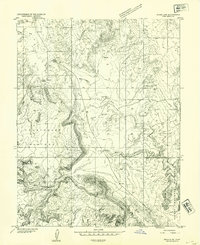
 1953 Orange Cliffs 1 NE1954 Print · USGSThe Green River meanders through the high desert of southeastern Utah in the early fifties, defining the borders of four counties. Trace the river's dramatic course through Stillwater Canyon past landmarks like Fort Bottom and Horsethief Point.
 - 1953 Map of The Spur, 1956 Print
 1953 The Spur1956 Print · USGSCattle ranching and ancient history intersect in this canyonlands survey from the early fifties. Researchers can trace the remote Tidwell Ranch and Petroglyphs alongside landmarks like Cleopatras Chair and the Green River.4 unique versions available
 - 1954 Map of Westwater 4 SW
 1954 Westwater 4 SW1954 Print · USGSGrand County in the mid-1950s is defined by the heavy rail traffic and dramatic desert drainages near the Colorado border. Genealogists and historians can trace the Denver and Rio Grande Western through Agate and down into Westwater Canyon.
 - 1954 Map of Mt Peale 1 NE
 1954 Mt Peale 1 NE1954 Print · USGSThe high borderlands between Utah and Colorado come into focus in the mid-1950s, showing a remote landscape of national forest and rugged canyons. Researchers can trace early water management at Buckeye Res and locate the site of a rural Sawmill near Pine Flat.
 - 1954 Map of Tidwell 1 NE, 1955 Print
 1954 Tidwell 1 NE1955 Print · USGSGrand County, Utah, is seen here during the mid-fifties as the railroad carved through the desert landscape. Genealogists and rail historians can trace the path of the Denver and Rio Grande Western between the sidings at Daly and Solitude.
 - 1954 Map of Mt. Waas 4 SE, 1955 Print
 1954 Mt. Waas 4 SE1955 Print · USGSThe high plateau country along the Utah-Colorado border comes into focus in the mid-1950s, showing a landscape shaped by timber and ranching. Researchers can locate remote sites like the Sawmill, Kirks Basin, and water sources at Pace Lake.
 - 1954 Map of Mt. Waas 4 SW, 1955 Print
 1954 Mt. Waas 4 SW1955 Print · USGSThe high La Sal Mountains of Grand and San Juan counties are documented in the mid-1950s just as modern aerial mapping was being finalized. Researchers can trace the drainage of Willow Creek or locate landmarks like Mt Waas and Taylor Flat.
 - 1954 Map of Mt. Waas 4 NE, 1955 Print
 1954 Mt. Waas 4 NE1955 Print · USGSThe high canyons along the Utah and Colorado border are captured here in the mid-fifties, just as aerial photogrammetry was refining our view of the desert. Researchers can trace the course of the Dolores River and find evidence of early mineral exploration at a lonely Prospect or the remote Landing Field.
Showing maps 1-25 of 607
Top cities of Grand County
Frequently asked questions
- What are the different types of historical maps available for Grand County?
- What is the oldest map of Grand County?
- Where can I purchase historical maps of Grand County for my home or office?
- Where can I download high-res historical maps of Grand County?
- Are there historical topographic maps available for Grand County?
- Is there historical aerial imagery available for Grand County?
- Where are historical maps of Grand County sourced from?