1970s Maps of Grand County, Utah
Explore 15 historic maps of Grand County from the 1970s. These maps offer a rare glimpse into what life looked like during the 1970s — showing old roads, neighborhoods, homes, and landmarks that have changed or disappeared over time.
Whether you're researching your family's past, planning a metal detecting trip, or studying how Grand County's landscape evolved across the 1970s, these high-resolution maps are a powerful tool for exploring the history of this region.
- Focus on a specific era: All maps on this page are from the 1970s, giving you a focused view of this time period.
- See what’s changed: Compare century-old streets, trails, and buildings to today's modern landscape using overlays and satellite layers.
- Research with precision: Use these maps for genealogy, historical research, land use analysis, or educational projects.
- View, download, or print: Maps are fully viewable online in high resolution, and can be downloaded or printed for your own records.
Start exploring Grand County's history through authentic maps from the 1970s. This is your window into the past.
Grand County, UT maps
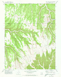
(15)- 1970 Map of Harley Dome, 1973 Print
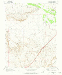
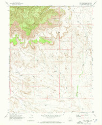
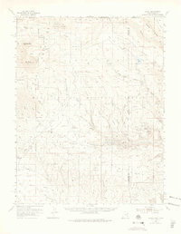
 1970 Harley Dome1973 Print · USGSGrand County’s high desert was a site of energy and transit transition in the early 1970s. Trace the path of the Old Railroad Grade and locate extraction points across the Harley Dome Gas Field and local Gravel Pits.2 unique versions available
 - 1970 Map of Flume Canyon, 1973 Print
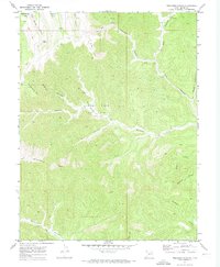
 1970 Flume Canyon1973 Print · USGSGrand County, Utah, is mapped here in the early 1970s, showing the high desert plateau where the Book Cliffs meet deep drainage systems. Researchers can trace energy exploration at the Cisco Springs North Gas Field or locate remote landmarks like Oak Springs and a canyon corral.3 unique versions available
 - 1970 Map of Cedar Camp Canyon, 1973 Print
 1970 Cedar Camp Canyon1973 Print · USGSThe high plateau of the Uintah and Grand County line is captured here in the early seventies during a period of active energy exploration. Researchers can trace the remote operations at the Gas Field and locate isolated landmarks like the Tomlinson Ranch or the Three Pines overlook.3 unique versions available
 - 1970 Map of Preacher Canyon, 1973 Print
 1970 Preacher Canyon1973 Print · USGSGrand County’s high plateaus and canyons are captured here in the early 1970s, showcasing a landscape of resource extraction. Trace the Diamond Ridge Gas Field alongside remote landmarks like Jumping Off Point and Red Spring.2 unique versions available
 - 1970 Map of Bar X Wash, 1973 Print
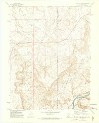
 1970 Bar X Wash1973 Print · USGSThe high-desert borderlands of Grand County and Mesa County are captured here in 1970 during an era of intensive energy exploration. Researchers can trace the network of the Stateline Gas Field and locate industrial landmarks like numerous gas wells and the steep slopes of the Book Cliffs.2 unique versions available
 - 1970 Map of Bitter Creek Well, 1973 Print
 1970 Bitter Creek Well1973 Print · USGSThe Utah-Colorado borderlands come alive in the early 1970s, showcasing a landscape of high-desert washes and deep canyons. Researchers can trace industrial markers like the Denver and Rio Grande Western Railroad, the Old Railroad Grade, and the landmark Bitter Creek Well.4 unique versions available
 - 1970 Map of Danish Flat, 1973 Print
 1970 Danish Flat1973 Print · USGSGrand County's high-desert industrial landscape is documented here during a period of active oil and gas exploration in the early seventies. Researchers can trace energy development through the Agate Oil Field and follow the path of the Denver and Rio Grande Western railroad.2 unique versions available
 - 1970 Map of P R Spring, 1973 Print
 1970 P R Spring1973 Print · USGSThe high plateau on the Uintah and Grand County line in the early seventies shows a landscape where remote ranching met the growing energy industry. Researchers can trace early energy infrastructure through the Gas Field and find legacy landmarks like Tomlinson Ranch and P R Spring.2 unique versions available
 - 1970 Map of San Arroyo Ridge, 1973 Print
 1970 San Arroyo Ridge1973 Print · USGSGrand and Uintah Counties are shown during a period of intense energy development in the early seventies. Researchers can trace the sprawling network of the San Arroyo Gas Field and locate the remote San Arroyo Camp near the Taylor Canyon Trail.2 unique versions available
 - 1970 Map of Bryson Canyon, 1973 Print
 1970 Bryson Canyon1973 Print · USGSThe high desert of Grand County is captured here in the early seventies as the energy industry began shaping the landscape. Researchers can trace the development of the Bar X Gas Field and find remote landmarks like Hat Rock and Lion Bench.2 unique versions available
 - 1970 Map of Cisco Springs, 1973 Print
 1970 Cisco Springs1973 Print · USGSGrand County ranching and resource exploration define this high desert terrain in the early seventies. Trace remote access routes along Book Cliffs and locate desert landmarks like Cisco Springs, Strychnine Pond, and Death Valley.3 unique versions available
 - 1970 Map of Antone Canyon, 1973 Print
 1970 Antone Canyon1973 Print · USGSGrand County, Utah, was a center for remote resource extraction and high desert ranching during the early 1970s. Researchers can trace the layout of the GAS FIELD, find vital water sources like Cato Springs, and follow rugged routes through Antone Canyon.2 unique versions available
 - 1970 Map of Jim Canyon, 1973 Print
 1970 Jim Canyon1973 Print · USGSThe Utah-Colorado borderlands come alive in this early 1970s survey of the high desert and energy country. Local historians and researchers can trace the development of the San Arroyo Gas Field and remote routes like the Jeep Trail through Jim Canyon.2 unique versions available
 - 1970 Map of Dry Canyon, 1973 Print
 1970 Dry Canyon1973 Print · USGSGrand County, Utah, is shown in the early 1970s as an active energy frontier where industry met historical trails. Trace the Robidoux Inscription and explore the industrial footprint of the Westwater Gas Field and Pear Park.2 unique versions available
 - 1974 Map of La Sal, 1975 Print
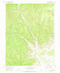
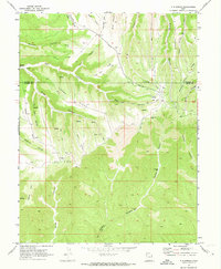
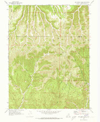
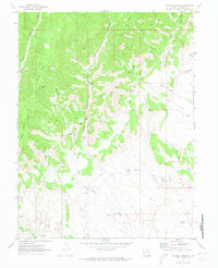
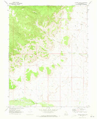
 1974 La Sal1975 Print · USGSThe high plateau and jagged peaks of the Utah-Colorado border come alive in the 1970s, showing a landscape defined by ranching and Cold War-era mining. Genealogists and historians can trace old homesteads like Pine Lodge Ranch or locate the numerous named claims including the Vanadium Queen Mine and Uranium Girl Mine.
End of results
Showing maps 1-15 of 15
Top cities of Grand County
Frequently asked questions
- What are the different types of historical maps available for Grand County?
- What is the oldest map of Grand County?
- Where can I purchase historical maps of Grand County for my home or office?
- Where can I download high-res historical maps of Grand County?
- Are there historical topographic maps available for Grand County?
- Is there historical aerial imagery available for Grand County?
- Where are historical maps of Grand County sourced from?