1980s Maps of Grand County, Utah
Explore 46 historic maps of Grand County from the 1980s. These maps offer a rare glimpse into what life looked like during the 1980s — showing old roads, neighborhoods, homes, and landmarks that have changed or disappeared over time.
Whether you're researching your family's past, planning a metal detecting trip, or studying how Grand County's landscape evolved across the 1980s, these high-resolution maps are a powerful tool for exploring the history of this region.
- Focus on a specific era: All maps on this page are from the 1980s, giving you a focused view of this time period.
- See what’s changed: Compare century-old streets, trails, and buildings to today's modern landscape using overlays and satellite layers.
- Research with precision: Use these maps for genealogy, historical research, land use analysis, or educational projects.
- View, download, or print: Maps are fully viewable online in high resolution, and can be downloaded or printed for your own records.
Start exploring Grand County's history through authentic maps from the 1980s. This is your window into the past.
Grand County, UT maps
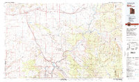
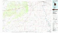
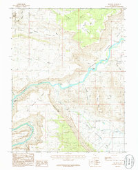
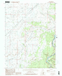
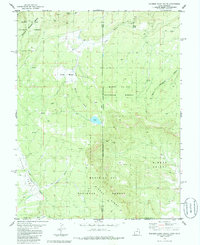
(46)- 1980 Map of Huntington, 1981 Print
 1980 Huntington1981 Print · USGSEmery and Carbon County landscapes are captured here during the early eighties, showcasing a region defined by high plateaus and mining towns. Researchers can trace the Denver and Rio Grande Western Railroad corridor and locate landmarks like the Cleveland-Lloyd Dinosaur Quarry and Hiawatha.
 - 1980 Map of Hanksville, 1987 Print
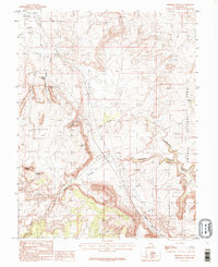
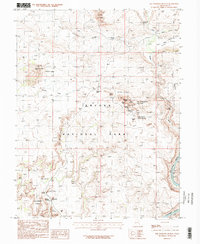
 1980 Hanksville1987 Print · USGSHanksville and the surrounding high desert are captured in the early 1980s, showcasing a landscape of dramatic topography and isolated outposts. Researchers can trace the rugged drainage of the Dirty Devil River and locate landmarks like the Factory Butte Mine and Robbers Roost Flats.2 unique versions available
 - 1980 Map of Westwater, 1987 Print
 1980 Westwater1987 Print · USGSGrand County, Utah, and western Colorado are captured here in the early 1980s as a landscape of deep canyons and energy extraction. Trace the path of the Denver and Rio Grande Western Railroad or locate landmarks like Westwater Creek and the Cisco Dome Oil Field.2 unique versions available
 - 1982 Map of La Sal, 1983 Print
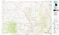
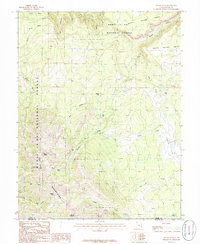
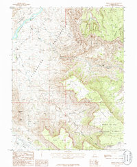
 1982 La Sal1983 Print · USGSThe high desert of southeastern Utah meets the Colorado border in the early eighties, showing a landscape defined by deep canyons and mining. Trace the industrial operations at Lisbon Mine or explore the early mapping of The Needles and Island in the Sky.2 unique versions available
 - 1983 Map of Moab
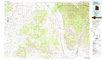
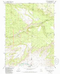
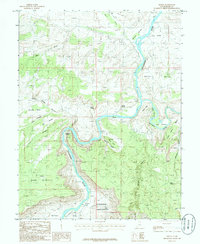
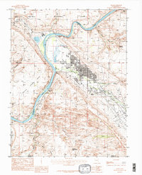
 1983 Moab1983 Print · USGSThe Colorado River corridor near Moab is captured here in the early eighties, showcasing a landscape of uranium mining and iconic parklands. Trace the Denver and Rio Grande Western RR as it passes through Cisco or locate landmarks like Delicate Arch and the Telluride Mines.3 unique versions available
 - 1985 Map of Chandler Falls
 1985 Chandler Falls1985 Print · USGSDesolation Canyon comes alive in the mid-1980s as the Green River cuts through the Utah wilderness. Researchers can trace the river's dangerous passage through Chandler Falls and Moonwater Rapids or locate remote landmarks like Natural Arch.
 - 1985 Map of Three Fords Canyon
 1985 Three Fords Canyon1985 Print · USGSThe Green River winds through Emery County in the mid-1980s, carving a path into the northern reaches of Desolation Canyon. Boaters and historians can trace a series of named whitewater features like Three Fords Rapids and Last Chance Rapids alongside the Uintah and Ouray Indian Reservation.
 - 1985 Map of San Rafael Desert
 1985 San Rafael Desert1985 Print · USGSEmery County was a landscape of deep canyons and uranium mining during the mid-eighties. Trace the remote trails through San Rafael Country to reach the Temple Mountain Mines, Mollys Castle, and the unique formations of Goblin Valley State Reserve.
 - 1985 Map of Steamboat Mesa, 1986 Print
 1985 Steamboat Mesa1986 Print · USGSThe Utah-Colorado state line meets on this high plateau during the mid-eighties, where the river and canyon define the border. Geologists and hunters can trace the rugged descent to the Dolores River and find named landmarks like Steamboat Mesa and Lost Horse Basin.
 - 1985 Map of Mount Waas, 1986 Print
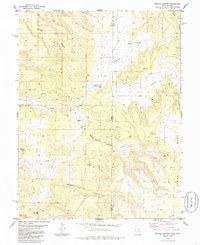
 1985 Mount Waas1986 Print · USGSThe high peaks of the La Sal Mountains are captured in the mid-1980s as they straddle the Grand and San Juan county lines. Topographic researchers can trace the rugged drainage patterns of Fisher Creek and Beaver Basin or locate landmarks like Mount Waas and Manns Peak.
 - 1985 Map of Westwater, 1986 Print
 1985 Westwater1986 Print · USGSThe Utah-Colorado borderlands come into focus in the mid-1980s as the river and rail corridor winds through high desert plateaus. Researchers can trace the path of the Denver and Rio Grande Western through Ruby Canyon and locate remote outposts like Westwater and Utaline.2 unique versions available
 - 1985 Map of Big Bend, 1986 Print
 1985 Big Bend1986 Print · USGSGrand County's dramatic canyon country is mapped here in the mid-1980s as the Colorado River winds past iconic formations. Trace the river's path through Whites Rapids and Big Bend or locate landmarks like Delicate Arch and Parriott Mesa.2 unique versions available
 - 1985 Map of Dewey, 1986 Print
 1985 Dewey1986 Print · USGSThe confluence of the Colorado and Dolores Rivers in the mid-1980s reveals a landscape of isolated settlements and dramatic canyon geology. Researchers can trace the riverfront layout of Dewey and Richardson or locate landmarks like the Natural Arch and Richardson Amphitheater.2 unique versions available
 - 1985 Map of Merrimac Butte, 1986 Print
 1985 Merrimac Butte1986 Print · USGSGrand County's high desert landscape is captured in the mid-eighties as it appeared before modern recreation pressures. Geologists and local historians can trace the intricate canyon networks of Sevenmile Canyon and locate landmarks like Merrimac Butte and the Uranium Arch.2 unique versions available
 - 1985 Map of Fisher Valley, 1986 Print
 1985 Fisher Valley1986 Print · USGSGrand County's canyonlands were documented in the mid-eighties as a landscape of remote resource extraction and national forest land. Geologists and local historians can trace mining activity on Polar Mesa through labeled Adits and Mine Shafts near the Dolores River.
 - 1985 Map of Agate, 1986 Print
 1985 Agate1986 Print · USGSGrand County, Utah, is captured in the early 1980s as a landscape of desert drainages and industrial corridors. Trace the path of the Old Railroad Grade and locate the junction of the Little Dolores River with the Colorado River Canyon.
 - 1985 Map of Dolores Point South, 1986 Print
 1985 Dolores Point South1986 Print · USGSThe high plateau of Beaver Mesa and the depths of Sinbad Valley define this mid-1980s borderland survey. Map collectors and researchers can trace remote Mines, isolated Prospects, and the winding Pack Trail across the Utah-Colorado line.2 unique versions available
 - 1985 Map of Moab, 1986 Print
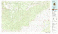
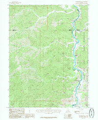
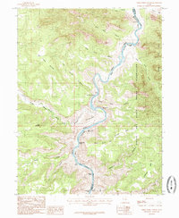
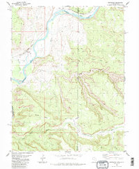
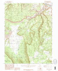
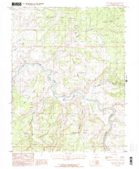
 1985 Moab1986 Print · USGSThe growing town of Moab is captured here in the mid-1980s, situated between the Colorado River and the red rock canyons of Arches National Park. Researchers can trace local landmarks and water sources like Jackson Reservoir, Matrimony Spring, and the nearby settlement of Emkay.3 unique versions available
 - 1985 Map of Big Triangle, 1986 Print
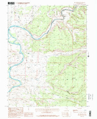 1985 Big Triangle1986 Print · USGSGrand County's river corridor and desert uplands are captured here in the mid-1980s, highlighting the technical waters of the Colorado River. River runners and historians can trace the positions of Skull Rapids, Cane Spring, and the remote Cisco Landing.2 unique versions available
 - 1985 Map of Rill Creek, 1986 Print
 1985 Rill Creek1986 Print · USGSThe Grand County high country and canyonlands appear here in the mid-1980s, documenting a landscape of steep mesas and vital water sources. Researchers can trace remote 4WD routes across Porcupine Rim or locate local landmarks like Coffee Pot Rock and the Rodeo Ground.2 unique versions available
 - 1985 Map of Fisher Towers, 1986 Print
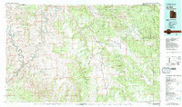
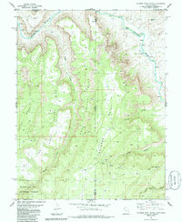
 1985 Fisher Towers1986 Print · USGSGrand County’s red rock landscape is captured in the mid-1980s, documenting a labyrinth of canyons and soaring spires. Trace the vertical reaches of Fisher Towers and Titan Tower, or locate the Priest and Nuns and the Onion Creek Rapids.
 - 1985 Map of Marble Canyon, 1986 Print
 1985 Marble Canyon1986 Print · USGSThe Utah-Colorado borderlands come into focus in the mid-1980s, showcasing a landscape of high-country ranching and remote aviation. You can trace the isolated operations at Picture Gallery Ranch and Spring Creek Ranch or follow the deep winding paths of Marble Canyon and Coates Creek.
 - 1985 Map of Blue Chief Mesa, 1986 Print
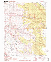
 1985 Blue Chief Mesa1986 Print · USGSThe high plateaus of Grand County were a focal point for mineral prospectors in the mid-1980s. Geologists and local historians can trace mining activity through several Adits, a Mine Shaft, and numerous Prospects near Blue Chief Mesa.
 - 1985 Map of Dolores Point North, 1986 Print
 1985 Dolores Point North1986 Print · USGSThe Utah-Colorado border highlands come alive in the mid-1980s, where the Dolores River carves through massive mesas. Researchers can trace mining history and land use across South Beaver Mesa and Dolores Point, locating numerous mines and remote water sources like DP Spring.2 unique versions available
 - 1985 Map of The Windows Section, 1986 Print
 1985 The Windows Section1986 Print · USGSArches National Park in the mid-1980s is captured here, showing the intricate network of geologic wonders before the advent of modern park infrastructure. You can trace the 4WD routes to legendary formations like Double Arch, The Organ, and the Garden of Eden.2 unique versions available
Showing maps 1-25 of 46
Top cities of Grand County
Frequently asked questions
- What are the different types of historical maps available for Grand County?
- What is the oldest map of Grand County?
- Where can I purchase historical maps of Grand County for my home or office?
- Where can I download high-res historical maps of Grand County?
- Are there historical topographic maps available for Grand County?
- Is there historical aerial imagery available for Grand County?
- Where are historical maps of Grand County sourced from?