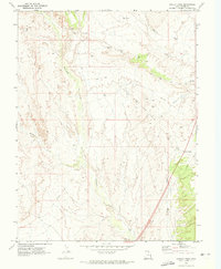
1970 Map of Harley Dome
USGS Topo · Published 1973About this map
Harley Dome Gas Field defines this high-desert landscape in Grand County during the early 1970s. The map captures a moment of industrial transition, where the Old Railroad Grade winds through the terrain, bypassed by the developing infrastructure required for regional energy extraction. The rugged topography is etched by seasonal watercourses like Westwater Creek, Sulphur Creek, and Bryson Wash, which provide the only breaks in the arid plateau.
Find a feature on this map
10 named features on this map. Tap any name to fly to it.
Don’t see what you’re looking for? This feature index may not catch every label — zoom into the map to look around manually.
Map Details
Editions of this 1970 Harley Dome Map
2 editions found
Other maps of this area

1885 · East Tavaputs
USGS Topo · 1:250,000

1954 · Westwater 4 SW
USGS Topo · 1:24,000

1956 · Westwater 4 SE
USGS Topo · 1:24,000

1956 · Grand Junction
USGS Topo · 1:250,000

1959 · Grand Junction
USGS Topo · 1:250,000

1960 · Grand Junction
USGS Topo · 1:250,000

1962 · Grand Junction
USGS Topo · 1:250,000

1964 · Grand Junction
USGS Topo · 1:250,000

1965 · Grand Junction
USGS Topo · 1:250,000
1970 · Bar X Wash
USGS Topo · 1:24,000