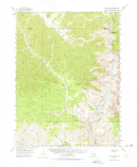
1954 Map of Range Creek
USGS Topo · Published 1975About this map
Pilling Ranch and Wilcox Ranch occupy a rare stretch of cultivable ground along the deep drainage of Range Canyon in the mid-1950s. The landscape is defined by the sharp descent from high-elevation plateaus like Valley Mtn down into the canyon systems of the Green River corridor. Along the eastern edge, the Uintah and Ouray Indian Reservation meets the river, where labels like McPherson Ranch and Florence Creek mark isolated outposts of human activity. The map records a complex network of branching drainages, including Cherry Meadow Creek and Lighthouse Canyon, which served as critical landmarks for navigating the high desert. To the south, the terrain levels out into the Last Chance Benches and Rabbit Valley, illustrating the varied topography of the Carbon and Emery County border lands.
Find a feature on this map
57 named features on this map. Tap any name to fly to it.
Don’t see what you’re looking for? This feature index may not catch every label — zoom into the map to look around manually.
Map Details
Editions of this 1954 Range Creek Map
3 editions found
Other maps of this area

1885 · East Tavaputs
USGS Topo · 1:250,000

1886 · Price River
USGS Topo · 1:250,000

1896 · Price River
USGS Topo · 1:250,000

1915 · Sunnyside
USGS Topo · 1:62,500

1948 · Woodside
USGS Topo · 1:62,500

1949 · Woodside
USGS Topo · 1:62,500

1950 · Woodside
USGS Topo · 1:62,500

1953 · Firewater Canyon
USGS Topo · 1:62,500

1954 · Flat Canyon
USGS Topo · 1:62,500

1954 · Range Creek
USGS Topo · 1:62,500