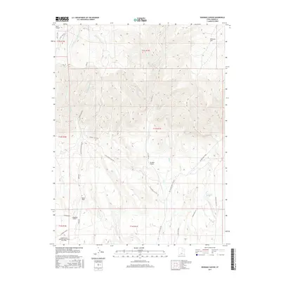
2017 Map of Deadman Canyon
USGS Topo · Published 2017About this map
Carbon County Regional Airport/Buck Davis Field serves as a modern landmark in this high-elevation landscape of the northern Colorado Plateau. The terrain is defined by a series of south-draining watercourses, including Deadman Cr, Coal Cr, and Bitter Cr, which have carved significant features like Deadman Canyon and Straight Canyon. This 2017 survey reveals a sophisticated network of industrial and utility roads, such as Coal Airport Cutoff Rd and Compressor Rd, illustrating the intersection of transportation infrastructure and energy development in the region. To the east, the drainage of Soldier Cr and the presence of Andersons Reservoir highlight the critical management of water in this arid environment. Significant mountain thoroughfares, including the Nine Mile Canyon Rd and Antone Creek Rd, provide access through the complex topography of Whitmore Park and the surrounding canyon systems.
Find a feature on this map
38 named features on this map. Tap any name to fly to it.
Don’t see what you’re looking for? This feature index may not catch every label — zoom into the map to look around manually.
Map Details
Editions of this 2017 Deadman Canyon Map
This is the sole edition of this map. No revisions or reprints were ever made.
Other maps of this area

1886 · Price River
USGS Topo · 1:250,000

1896 · Price River
USGS Topo · 1:250,000

1914 · Castle Gate
USGS Topo · 1:62,500

1915 · Wellington
USGS Topo · 1:62,500

1916 · Castle Gate
USGS Topo · 1:62,500

1956 · Price
USGS Topo · 1:250,000

1960 · Price
USGS Topo · 1:250,000

1962 · Price
USGS Topo · 1:250,000
1969 · Minnie Maud Creek East
USGS Topo · 1:24,000
1969 · Minnie Maud Creek West
USGS Topo · 1:24,000