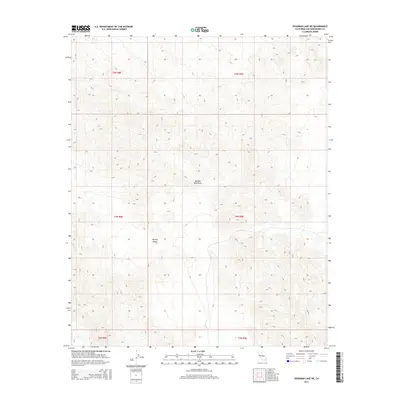
2015 Map of Deadman Lake NE
USGS Topo · Published 2015About this map
The Bullion Mountains dominate this arid landscape within the eastern Mojave Desert. The map reveals a complex system of steep ridges and deep, unnamed canyons characteristic of this desert range, illustrating the stark topography of San Bernardino County. Without roads or permanent settlements shown, the terrain is defined strictly by its natural elevation and the public land survey grid, including sections of t5n r9e and t4n r8e. This 2015 edition provides a modern look at the undisturbed wilderness of the high desert, where topographic detail highlights the drainage patterns and rocky outcrops that define the local geology.
Find a feature on this map
8 named features on this map. Tap any name to fly to it.
Don’t see what you’re looking for? This feature index may not catch every label — zoom into the map to look around manually.
Map Details
Editions of this 2015 Deadman Lake NE Map
This is the sole edition of this map. No revisions or reprints were ever made.
Other maps of this area

1942 · Amboy
USGS Topo · 1:250,000

1943 · Amboy
USGS Topo · 1:250,000

1953 · San Bernardino
USGS Topo · 1:250,000

1954 · Needles
USGS Topo · 1:250,000

1954 · Bagdad SW
USGS Topo · 1:24,000

1954 · Ludlow SE
USGS Topo · 1:24,000

1955 · Deadman Lake NW
USGS Topo · 1:24,000

1955 · Morgans Well
USGS Topo · 1:24,000

1955 · Lead Mountain
USGS Topo · 1:24,000

1955 · Deadman Lake SE
USGS Topo · 1:24,000