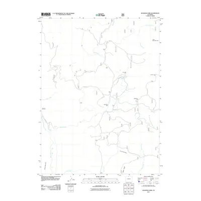
2011 Map of Deadman Park
USGS Topo · Published 2011About this map
Glendevey Post Office stands as a focal point of early 21st-century settlement near the western edge of this Larimer County landscape. The area is defined by a complex network of high-altitude water management, including the Columbine Ditch and Davy Ditch, which divert alpine flows across the terrain. These engineering features highlight the importance of water rights and irrigation in the region, supporting local activity alongside the North Fork Cache La Poudre River.
Find a feature on this map
26 named features on this map. Tap any name to fly to it.
Don’t see what you’re looking for? This feature index may not catch every label — zoom into the map to look around manually.
Map Details
Editions of this 2011 Deadman Park Map
This is the sole edition of this map. No revisions or reprints were ever made.
Other maps of this area

1916 · Home
USGS Topo · 1:125,000

1920 · Home
USGS Topo · 1:125,000

1954 · Greeley
USGS Topo · 1:250,000

1957 · Greeley
USGS Topo · 1:250,000

1958 · Greeley
USGS Topo · 1:250,000

1961 · Greeley
USGS Topo · 1:250,000

1962 · Boston Peak
USGS Topo · 1:24,000

1962 · Kinikinik
USGS Topo · 1:24,000
1962 · Rawah Lakes
USGS Topo · 1:24,000

1964 · Greeley
USGS Topo · 1:250,000