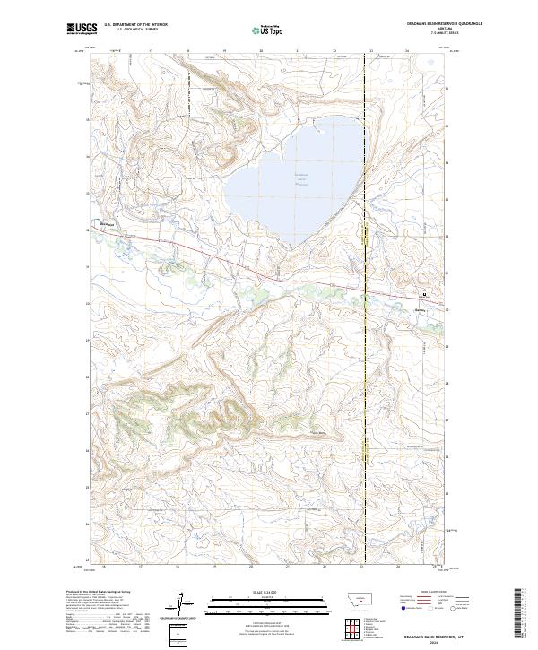
2024 Map of Deadmans Basin Reservoir
USGS Topo · Published 2024About this map
The Musselshell River winds through the heart of this landscape, anchoring a network of water management centered on the Deadmans Basin Reservoir. The interplay between natural waterways and engineered irrigation is evident in the Deadmans Basin Supply Canal and the Deadmans Basin Outlet Canal, which redirect water across the valley floor. Settlement is concentrated in the small communities of Shawmut and Barber, both positioned near the river.
Find a feature on this map
32 named features on this map. Tap any name to fly to it.
Don’t see what you’re looking for? This feature index may not catch every label — zoom into the map to look around manually.
Map Details
Editions of this 2024 Deadmans Basin Reservoir Map
This is the sole edition of this map. No revisions or reprints were ever made.
Other maps of this area

1889 · Big Snowy Mountain
USGS Topo · 1:250,000

1893 · Big Snowy Mountain
USGS Topo · 1:250,000

1954 · Roundup
USGS Topo · 1:250,000

1958 · Roundup
USGS Topo · 1:250,000
1985 · Locomotive Butte
USGS Topo · 1:24,000

1985 · Progress
USGS Topo · 1:24,000
1985 · O'Brien Hill
USGS Topo · 1:24,000

1986 · Ryegate West
USGS Topo · 1:24,000

1986 · Shawmut
USGS Topo · 1:24,000

1986 · Halbert Creek South
USGS Topo · 1:24,000