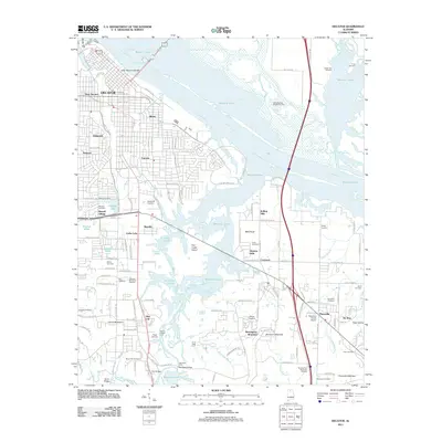
2011 Map of Decatur
USGS Topo · Published 2011About this map
The Tennessee River and the expansive waters of Wheeler Lake dominate this 2011 survey, illustrating the modern geography of Morgan County. The city of Decatur occupies the northwest, where the Keller Memorial Bridge links it across the water. Surrounding residential growth and established neighborhoods like Oakworth, Fairview, and Albany are clearly defined. Southward, the map details the intricate waterways of Flint Creek, including Crabtree Slough and Dinsmore Slough, which weave through the lowlands before joining the main river system.
Find a feature on this map
142 named features on this map. Tap any name to fly to it.
Don’t see what you’re looking for? This feature index may not catch every label — zoom into the map to look around manually.
Map Details
Editions of this 2011 Decatur Map
This is the sole edition of this map. No revisions or reprints were ever made.
Other maps of this area

1888 · Cullman
USGS Topo · 1:125,000

1888 · Huntsville
USGS Topo · 1:125,000

1892 · Cullman
USGS Topo · 1:125,000

1892 · Huntsville
USGS Topo · 1:125,000

1935 · Danville
USGS Topo · 1:48,000

1936 · Hartselle
USGS Topo · 1:24,000

1936 · Decatur
USGS Topo · 1:24,000

1936 · Stewart Cross Roads
USGS Topo · 1:24,000

1936 · Trinity
USGS Topo · 1:24,000

1936 · Somerville
USGS Topo · 1:24,000