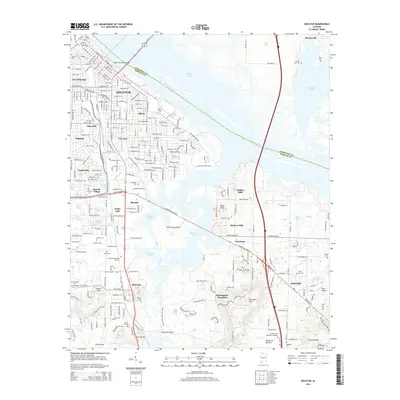
2014 Map of Decatur
USGS Topo · Published 2014About this map
The Tennessee River and the sprawling waters of Wheeler Lake dominate this 2014 survey of the Morgan and Limestone county border. The city of Decatur is shown in detail, including established neighborhoods like Albany, Oakworth, and West Decatur. To the north, the Keller Memorial Bridge provides a vital link across the river toward the historic settlement of Mooresville. This era reveals a landscape shaped by both urban density and the riparian environment of the Flint Creek Island area.
Find a feature on this map
72 named features on this map. Tap any name to fly to it.
Don’t see what you’re looking for? This feature index may not catch every label — zoom into the map to look around manually.
Map Details
Editions of this 2014 Decatur Map
This is the sole edition of this map. No revisions or reprints were ever made.
Other maps of this area

1888 · Cullman
USGS Topo · 1:125,000

1888 · Huntsville
USGS Topo · 1:125,000

1892 · Cullman
USGS Topo · 1:125,000

1892 · Huntsville
USGS Topo · 1:125,000

1935 · Danville
USGS Topo · 1:48,000

1936 · Hartselle
USGS Topo · 1:24,000

1936 · Decatur
USGS Topo · 1:24,000

1936 · Stewart Cross Roads
USGS Topo · 1:24,000

1936 · Trinity
USGS Topo · 1:24,000

1936 · Somerville
USGS Topo · 1:24,000