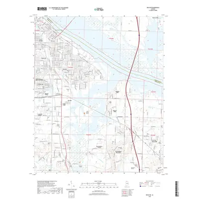
2018 Map of Decatur
USGS Topo · Published 2018About this map
Decatur and its surrounding Morgan County communities are defined by their relationship to the Tennessee River and the sprawling waters of Wheeler Lake. The city's mid-century expansion is visible through established neighborhoods like Fairview and Bayside, while the Keller Memorial Bridge serves as the primary artery crossing the water into Limestone County. This 2018 survey reveals a landscape of varied elevation, rising from the wetlands of the Harris-Sweetwater Dewatering Area to the heights of Burningtree Mountain and Priceville Mtn. To the south and east, the transition from urban centers to more rural terrain is marked by family-named landmarks and local burial grounds, including Pisgah Cem and Rountree Cem, which offer significant value for genealogical research. The complex hydrology of the region is evident in the numerous sloughs, such as Garth Slough and Crabtree Slough, that lace through the lowlands.
Find a feature on this map
68 named features on this map. Tap any name to fly to it.
Don’t see what you’re looking for? This feature index may not catch every label — zoom into the map to look around manually.
Map Details
Editions of this 2018 Decatur Map
This is the sole edition of this map. No revisions or reprints were ever made.
Other maps of this area

1888 · Cullman
USGS Topo · 1:125,000

1888 · Huntsville
USGS Topo · 1:125,000

1892 · Cullman
USGS Topo · 1:125,000

1892 · Huntsville
USGS Topo · 1:125,000

1935 · Danville
USGS Topo · 1:48,000

1936 · Hartselle
USGS Topo · 1:24,000

1936 · Decatur
USGS Topo · 1:24,000

1936 · Stewart Cross Roads
USGS Topo · 1:24,000

1936 · Trinity
USGS Topo · 1:24,000

1936 · Somerville
USGS Topo · 1:24,000