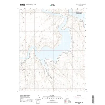
2020 Map of Deep Canyon North
USGS Topo · Published 2020About this map
Piute Canyon and Deep Canyon dominate the southern reaches of this landscape, where deep drainages carve through the high plateaus of San Juan County. This 2020 map documents the complex topography of the Glen Canyon National Recreation Area, centered on the confluence of the San Juan River and its various flooded tributaries. The rise of reservoir waters has transformed former river bottoms into features like Piute Bay and the San Juan Arm, leaving high landmarks such as Grey Mesa and Wilson Mesa as prominent overlooks. The geography recorded here captures the modern state of the shoreline as it winds through Neskahi Wash and into the San Juan Valley, illustrating how the desert terrain has been reshaped by the presence of Lake Powell.
Find a feature on this map
10 named features on this map. Tap any name to fly to it.
Don’t see what you’re looking for? This feature index may not catch every label — zoom into the map to look around manually.
Map Details
Editions of this 2020 Deep Canyon North Map
This is the sole edition of this map. No revisions or reprints were ever made.
Other maps of this area

1886 · Henry Mountains
USGS Topo · 1:250,000

1892 · Henry Mountains
USGS Topo · 1:250,000

1952 · Navajo Mtn. 4 SE
USGS Topo · 1:24,000

1952 · Navajo Mountain 4 NE
USGS Topo · 1:24,000

1953 · Navajo Mountain 4 NW
USGS Topo · 1:24,000

1953 · Navajo Mountain 4 SW
USGS Topo · 1:24,000

1953 · The Rincon
USGS Topo · 1:62,500

1953 · Lake Canyon
USGS Topo · 1:62,500

1953 · Navajo Mountain
USGS Topo · 1:62,500

1953 · No Mans Mesa
USGS Topo · 1:62,500