
1953 Map of The Rincon
USGS Topo · Published 1956About this map
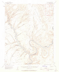
The Colorado River carves a deep path through southern Utah in this 1950s survey, defined by the striking geology of Glen Canyon and the Waterpocket Fold. This sheet documents a landscape of immense stratigraphic complexity before the regional river systems were altered by later development. High-elevation landmarks like Iron Top Mesa and Fortymile Ridge overlook a network of tributary drainages including the Escalante River, Coyote Creek, and Davis Gulch. Notable for its geological features, the area contains Skyline Natural Bridge and Gregory Natural Bridge, along with several arches. Historical passage through this labyrinthine terrain is marked by the Hole in the Rock Historical Marker, denoting the arduous route taken by early pioneers at a narrow gap in the canyon walls. Further downstream, the river snakes around The Rincon, an abandoned meander loop that serves as a prominent landmark for navigation and mapping.
Find a feature on this map
30 named features on this map. Tap any name to fly to it.
Don’t see what you’re looking for? This feature index may not catch every label — zoom into the map to look around manually.
Map Details
Editions of this 1953 The Rincon Map
3 editions found
Other maps of this area

1886 · Escalante
USGS Topo · 1:250,000

1886 · Henry Mountains
USGS Topo · 1:250,000

1892 · Henry Mountains
USGS Topo · 1:250,000

1953 · Mt Pennell 3 SW
USGS Topo · 1:24,000

1953 · Navajo Mountain 4 NW
USGS Topo · 1:24,000

1953 · Cummings Mesa
USGS Topo · 1:62,500

1953 · Lake Canyon
USGS Topo · 1:62,500

1953 · Mt. Ellsworth
USGS Topo · 1:62,500

1953 · Hall Mesa
USGS Topo · 1:62,500

1953 · Navajo Mountain
USGS Topo · 1:62,500