Old Maps of Kane County, Utah
Explore 628 old maps of Kane County, spanning from 1886 to today. These high-resolution historic maps reveal how streets, neighborhoods, landmarks, and natural features evolved over time — perfect for genealogy, metal detecting, research, and local history exploration.
What you can do with these maps:
- See how Kane County changed over time: Compare historical maps to modern-day views to trace roads, homesites, rail lines & more.
- View detailed metadata: Each map includes creators, publishers, year, scale, and archive source.
- Overlay maps with satellite & LiDAR: Visualize the past alongside modern tools to explore terrain & human change.
- Trusted historical sources: Maps sourced from the USGS, Library of Congress, and other archives.
- Access maps your way: View online, download high-res files, or order prints for personal or research use.
Start exploring old maps of Kane County to uncover forgotten places, hidden landmarks, and the deep history beneath your feet.
Kane County, UT maps
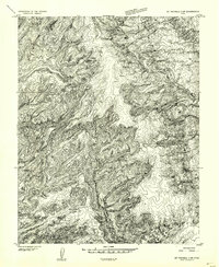
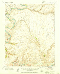
(628)- 1886 Map of Kanab
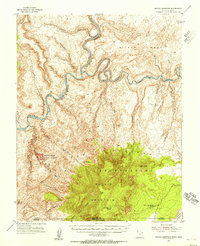
 1886 Kanab1886 Print · USGSSouthern Utah in the late nineteenth century remains a frontier of deep canyons and high plateaus. Researchers can trace early pioneer outposts and river settlements like Orderville, Mt. Carmel, and Kanab tucked beneath the Vermilion Cliffs.5 unique versions available
 - 1886 Map of Escalante
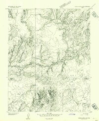
 1886 Escalante1886 Print · USGSSouthern Utah in the late 1880s was a landscape of formidable geological barriers and isolated river crossings. Modern researchers can trace the early layout of Escalante and identify historic points like The Crossing of the Fathers and Potato Valley.5 unique versions available
 - 1886 Map of Henry Mountains
 1886 Henry Mountains1886 Print · USGSSouthern Utah remains a wilderness of deep canyons and volcanic peaks in this 1880s survey. Researchers can trace the original courses of the Colorado River through Cataract Canyon and find landmarks like Navajo Mt and Monument Valley.
 - 1892 Map of Henry Mountains
 1892 Henry Mountains1892 Print · USGSSouthern Utah in the late 1800s remains a wilderness of deep canyons and isolated peaks under the direction of J.W. Powell. Geologists and historians can trace the geological spine of the Water Pocket Fold and the early boundaries of the Navajo Indian Res. near Monument Valley.6 unique versions available
 - 1922 Map of Warm Creek
 1922 Warm Creek1922 Print · USGSSouthern Utah's canyon country appears here in the early twenties, just as the first formal topographic surveys reached the Colorado River. Researchers can trace the legendary Crossing of the Fathers and locate the remote Warm Creek Cabin near the Utah-Arizona Boundary Line.
 - 1922 Map of Upper Last Chance
 1922 Upper Last Chance1922 Print · USGSSouthern Utah's high plateaus and deep drainages were captured in this 1920s reconnaissance survey. Genealogists and desert historians can trace the early mapped paths of Last Chance Ck, Smoky Mtn., and Little Last Chance Ck.
 - 1922 Map of Rees Canyon
 1922 Rees Canyon1922 Print · USGSSouthern Utah's canyon country appears in remarkable detail during the early 1920s, showing the land as it was first systematically surveyed. Researchers can trace the winding course of Rees Canyon and the intricate drainage of West Chance Creek.
 - 1953 Map of Mt Pennell 3 SW, 1954 Print
 1953 Mt Pennell 3 SW1954 Print · USGSSouthern Utah’s high plateau country is captured in the early 1950s as a complex network of canyons and drainage basins. Researchers can trace the winding course of East Moody Canyon and locate geographic markers such as Miller Creek and the high point at VABM 6748.
 - 1953 Map of Circle Cliffs 4 SW, 1954 Print
 1953 Circle Cliffs 4 SW1954 Print · USGSSouthern Utah's high desert benches and river corridors are meticulously charted in the mid-1950s as topographic mapping of the Colorado Plateau expanded. Researchers can trace the winding path of the Escalante River and explore named terrain like Scorpion Flat and Baker Bench.
 - 1953 Map of Cummings Mesa, 1955 Print
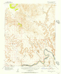
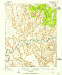 1953 Cummings Mesa1955 Print · USGSGlen Canyon and the Colorado River borderlands appear here in the early fifties, before modern changes to the river's flow. You can trace the remote locations of river bars and canyons such as Klondike Bar, Wild Horse Bar, and the depths of Glen Canyon.3 unique versions available
 - 1953 Map of The Rincon, 1956 Print
 1953 The Rincon1956 Print · USGSSouthern Utah’s high desert is captured in the early fifties, just as the canyon country was being systematically mapped for its geology and navigation. Researchers can locate remote landmarks like the Hole in the Rock Historical Marker and the iconic Gregory Natural Bridge.3 unique versions available
 - 1953 Map of Lake Canyon, 1956 Print
 1953 Lake Canyon1956 Print · USGSSoutheastern Utah remains an intricate labyrinth of deep canyons and river bends during the early fifties. Researchers can trace the original paths of the Colorado River and San Juan River, identifying Cliff Dwellings, the historic Hall Trail, and various named river bars.3 unique versions available
 - 1953 Map of Mt. Ellsworth, 1956 Print
 1953 Mt. Ellsworth1956 Print · USGSThe Colorado River corridor near the Henry Mountains appears here in the mid-1950s, shortly before the flooding of the canyon floor. Researchers can trace the original river course past Good Hope Bar, Olympia Bar, and the rugged Hoskinnini Mesa.4 unique versions available
 - 1953 Map of Hall Mesa, 1956 Print
 1953 Hall Mesa1956 Print · USGSGarfield County's high desert was a landscape of remote ranching and early resource exploration in the 1950s. You can trace the rugged descent of the Waterpocket Fold and locate isolated landmarks like the Baker Ranch and a remote Landing Strip.4 unique versions available
 - 1953 Map of Nipple Butte, 1956 Print
 1953 Nipple Butte1956 Print · USGSThe high plateaus of the Utah-Arizona border are shown here in the early fifties, before the landscape was altered by massive downstream damming. Researchers can trace remote water sources and cattle-country landmarks like Jacobs Tanks, Alkali Seep, and the Windmill below Nipple Butte.2 unique versions available
 - 1953 Map of Navajo Mountain, 1956 Print
 1953 Navajo Mountain1956 Print · USGSThe high desert and river canyons of the Utah-Arizona border are shown here in the early 1950s, before the landscape was altered by major dams. Researchers can trace remote trails leading to Rainbow Bridge National Monument, the Navajo Mountain Sch, and War God Spring.3 unique versions available
 - 1953 Map of Gunsight Butte, 1956 Print
 1953 Gunsight Butte1956 Print · USGSGlen Canyon and the Colorado River appear here in the early fifties, before the landscape was transformed by the rising waters of Lake Powell. Researchers can trace the original riverbed past the Crossing of the Fathers and identify landmarks like Gunsight Butte and Alstrom Point.3 unique versions available
 - 1953 Map of Moody Creek, 1957 Print
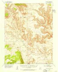
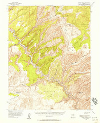 1953 Moody Creek1957 Print · USGSGarfield and Kane Counties are shown in the early fifties as a labyrinth of high sandstone plateaus and deep river canyons. Researchers can trace remote mining activity at the Hotshot Prospect or locate a mid-century Landing Strip deep within the Circle Cliffs.4 unique versions available
 - 1953 Map of Cedar City, 1966 Print
 1953 Cedar City1966 Print · USGSSouthwestern Utah's high plateaus and desert basins are mapped here during the mid-fifties, showing the region before the modern interstate system. Researchers can trace historic mining at Silver Reef, follow the Union Pacific line, and locate early settlements like Kanarraville and Toquerville.3 unique versions available
 - 1954 Map of Buckskin Gulch NW
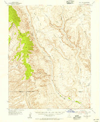
 1954 Buckskin Gulch NW1954 Print · USGSKane County ranching life in the mid-fifties centered on isolated outposts in a landscape of deep canyons and high points. Researchers can trace historic land use at Nephi Ranch and Clark Ranch or locate water sources like Wildcat Spring.
 - 1954 Map of Buckskin Gulch NE
 1954 Buckskin Gulch NE1954 Print · USGSKane County in the mid-1950s was a landscape defined by cattle ranching and deep desert canyons. Researchers can trace historic routes like Paria Road and locate remote water sources such as Kitchen Corral Spring and Water Holes.
 - 1954 Map of Buckskin Gulch SE
 1954 Buckskin Gulch SE1954 Print · USGSThe high desert borderlands between Utah and Arizona are mapped here in the mid-1950s, showcasing a landscape of deep canyons and isolated ranching outposts. Researchers can trace the rugged cattle country surrounding Jepson Ranch and follow old routes through Buckskin Gulch and Wire Pass.
 - 1954 Map of Buckskin Gulch SW
 1954 Buckskin Gulch SW1954 Print · USGSRanching life on the Utah-Arizona border during the mid-fifties centered on isolated homesteads and dependable water sources. Researchers can trace the layout of Hoda Ranch and School Section Ranch or follow the Old Arizona Road across the desert.
 - 1954 Map of Johnson SE, 1956 Print
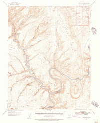
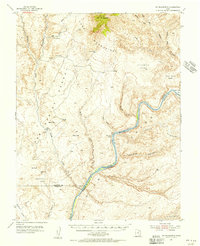
 1954 Johnson SE1956 Print · USGSThe high desert of the Utah-Arizona border comes into focus in the mid-1950s, showing a land of deep canyons and seasonal washes. Trace the early road network from Johnson (Site) past Cliff Dwellings and essential water sources like Navajo Well.
 - 1954 Map of Kanab SW, 1956 Print
 1954 Kanab SW1956 Print · USGSThe Utah-Arizona borderlands in the mid-1950s reveal a landscape of isolated springs and deep drainages. Researchers can trace the rugged terrain of Yellowjacket Canyon and locate remote water sources like Sand Spring and Harris Springs.
Showing maps 1-25 of 628
Top cities of Kane County
- Kanab historical maps
- Orderville historical maps
- Big Water historical maps
- Glendale historical maps
- Alton historical maps
Frequently asked questions
- What are the different types of historical maps available for Kane County?
- What is the oldest map of Kane County?
- Where can I purchase historical maps of Kane County for my home or office?
- Where can I download high-res historical maps of Kane County?
- Are there historical topographic maps available for Kane County?
- Is there historical aerial imagery available for Kane County?
- Where are historical maps of Kane County sourced from?