
1953 Map of Cummings Mesa
USGS Topo · Published 1955About this map
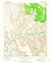
The Colorado River carves a deep path through the high desert of the Colorado Plateau in the early 1950s, revealing a landscape defined by dramatic elevation changes and remote river bars. This survey captures Glen Canyon before its transformation, showing the original river course and its various sediment deposits like Klondike Bar, Wild Horse Bar, and Meskin Bar. These riverside features, along with the towering Straight Cliffs and Cummings Mesa, illustrate the complex geology of the border between Utah and Arizona. To the south, the Navajo Indian Reservation encompasses the Rainbow Plateau, while the northern portion of the map is dominated by the Grand Bench and the drainages of Rock Creek and Last Chance Creek. The map documents a rugged era of backcountry navigation and topographic study by the Geological Survey and USC&GS.
Find a feature on this map
21 named features on this map. Tap any name to fly to it.
Don’t see what you’re looking for? This feature index may not catch every label — zoom into the map to look around manually.
Map Details
Editions of this 1953 Cummings Mesa Map
3 editions found
Other maps of this area

1883 · Marsh Pass
USGS Topo · 1:250,000

1886 · Escalante
USGS Topo · 1:250,000

1886 · Henry Mountains
USGS Topo · 1:250,000

1886 · Echo Cliffs
USGS Topo · 1:250,000

1891 · Echo Cliffs
USGS Topo · 1:250,000

1892 · Marsh Pass
USGS Topo · 1:250,000

1892 · Henry Mountains
USGS Topo · 1:250,000

1922 · Warm Creek
USGS Topo · 1:63,360

1922 · Rees Canyon
USGS Topo · 1:63,360

1953 · The Rincon
USGS Topo · 1:62,500