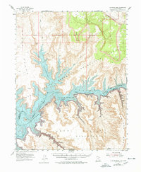
1953 Map of Cummings Mesa
USGS Topo · Published 1978About this map
Lake Powell and the Colorado River dominate this canyon landscape, defining the intersection of Utah and Arizona long before modern development transformed the region. The map details the transition from the high Kaiparowits Plateau and Fiftymile Mountain in the north down to the deep drainages of Rock Creek Bay. The complex topography is punctuated by river bars like Klondike Bar and Wild Horse Bar, which served as critical landmarks for early river travelers and prospectors. To the south, the Navajo Indian Reservation boundary follows the river’s path, while the massive Cummings Mesa rises as a prominent landmark. This 1953 survey, with revisions noted through the late 1970s, captures the remote character of Glen Canyon National Recreation Area and the dramatic verticality of the Straight Cliffs.
Find a feature on this map
25 named features on this map. Tap any name to fly to it.
Don’t see what you’re looking for? This feature index may not catch every label — zoom into the map to look around manually.
Map Details
Editions of this 1953 Cummings Mesa Map
3 editions found
Other maps of this area

1883 · Marsh Pass
USGS Topo · 1:250,000

1886 · Escalante
USGS Topo · 1:250,000

1886 · Henry Mountains
USGS Topo · 1:250,000

1886 · Echo Cliffs
USGS Topo · 1:250,000

1891 · Echo Cliffs
USGS Topo · 1:250,000

1892 · Marsh Pass
USGS Topo · 1:250,000

1892 · Henry Mountains
USGS Topo · 1:250,000

1922 · Warm Creek
USGS Topo · 1:63,360

1922 · Rees Canyon
USGS Topo · 1:63,360

1953 · Cummings Mesa
USGS Topo · 1:62,500