1960s Maps of Kane County, Utah
Explore 36 historic maps of Kane County from the 1960s. These maps offer a rare glimpse into what life looked like during the 1960s — showing old roads, neighborhoods, homes, and landmarks that have changed or disappeared over time.
Whether you're researching your family's past, planning a metal detecting trip, or studying how Kane County's landscape evolved across the 1960s, these high-resolution maps are a powerful tool for exploring the history of this region.
- Focus on a specific era: All maps on this page are from the 1960s, giving you a focused view of this time period.
- See what’s changed: Compare century-old streets, trails, and buildings to today's modern landscape using overlays and satellite layers.
- Research with precision: Use these maps for genealogy, historical research, land use analysis, or educational projects.
- View, download, or print: Maps are fully viewable online in high resolution, and can be downloaded or printed for your own records.
Start exploring Kane County's history through authentic maps from the 1960s. This is your window into the past.
Kane County, UT maps
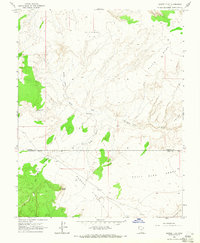
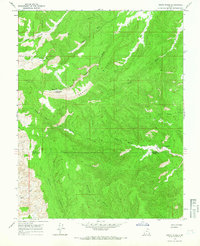
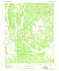
(36)- 1960 Map of Escalante
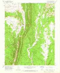
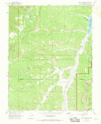
 1960 Escalante1960 Print · USGSSouthern Utah and northern Arizona appear at a historic turning point in the late fifties as Lake Powell begins to reshape the canyons. Researchers can trace remote sites like Goulding Trading Post, a lonely Uranium Mine, and Coyote Ranches before the reservoir's rise.
 - 1962 Map of Cedar City
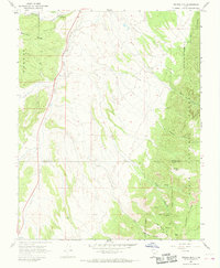
 1962 Cedar City1962 Print · USGSSouthern Utah in the early sixties showcases a landscape of dramatic plateaus and historic mining outposts. Trace the early settlement patterns at the Silver Reef (ruins), locate the Iron Mine near the Hurricane Cliffs, or find the Fort Harmony Monument.
 - 1964 Map of Sunset Flat, 1965 Print
 1964 Sunset Flat1965 Print · USGSGarfield County's high desert plateaus are captured here in the mid-sixties, showing a landscape of remote livestock ranges and primitive trails. Researchers can trace the era's pastoral movement through sites like Twentymile Mile Corral, Harris, and Early Weed Bench.2 unique versions available
 - 1964 Map of Horse Flat, 1965 Print
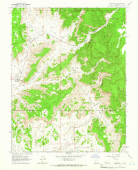
 1964 Horse Flat1965 Print · USGSKane County in the mid-1960s was a landscape of high benches and deep washes accessible only by primitive routes. Researchers can trace the path of the central Jeep Trail and locate family-named landmarks like Jack Riggs Bench and Tommy Smith Creek.2 unique versions available
 - 1964 Map of Canaan Peak, 1966 Print
 1964 Canaan Peak1966 Print · USGSSouthern Utah's high desert and the Dixie National Forest are shown here in the mid-1960s as a landscape of remote trails and seasonal washes. Researchers can trace early routes like the Pack Trails through Headquarters Valley and locate landmarks like Canaan Peak and Horse Spring.
 - 1964 Map of Seep Flat, 1966 Print
 1964 Seep Flat1966 Print · USGSGarfield and Kane counties in the mid-1960s were characterized by high desert plateaus and deeply carved canyons. Trace the remote network of water sources and landmarks like Barney Reservoir, the Devils Garden, and Twentymile Corral.2 unique versions available
 - 1964 Map of Death Ridge, 1966 Print
 1964 Death Ridge1966 Print · USGSThe high plateau of southern Utah is captured in the mid-sixties, showing the remote canyonlands along the Garfield and Kane county line. Researchers can trace livestock and travel routes between essential water sources like Horse Spring, Star Seep, and the Death Ridge Reservoir.2 unique versions available
 - 1964 Map of Henrieville, 1966 Print
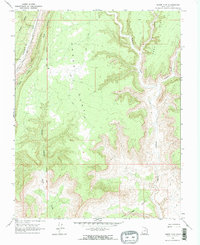
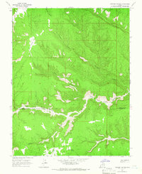
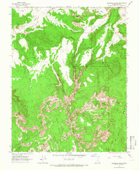
 1964 Henrieville1966 Print · USGSHenrieville was a remote ranching hub in southern Utah during the mid-sixties, serving as the gateway to a vast system of plateaus and valleys. Genealogists and historians can trace the early infrastructure of the area through sites like Henrieville Spring, Chimney Rock, and the expansive Big Dry Valley.
 - 1964 Map of Carcass Canyon, 1966 Print
 1964 Carcass Canyon1966 Print · USGSThe Straight Cliffs of Southern Utah stand out in this mid-1960s survey, mapping the high plateau terrain where Garfield and Kane counties meet. Modern researchers can trace remote water sources like Hardhead Water Spring and landmarks such as Camp Flat and Sarah Ann Canyon.
 - 1964 Map of Calico Peak, 1966 Print
 1964 Calico Peak1966 Print · USGSKane County's high desert plateaus and deep canyons are frozen in time during the mid-sixties, before this portion of the Paria River drainage became more widely traveled. Researchers can trace the rugged contours of The Cocscomb and locate remote landmarks like Natural Arch and the secluded No Mans Mesa.4 unique versions available
 - 1964 Map of Butler Valley, 1966 Print
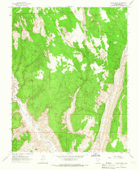
 1964 Butler Valley1966 Print · USGSKane County's high desert plateaus and dramatic ridge lines are captured here in the mid-1960s. Researchers can trace the network of jeep trails leading to remote sites like the Headquarters Cabin and the landmark Grosvenor Arch.2 unique versions available
 - 1964 Map of Slickrock Bench, 1966 Print
 1964 Slickrock Bench1966 Print · USGSKane County was a network of remote canyons and cattle paths in the mid-1960s. Genealogists and historians can trace traditional backcountry routes via the Pack Trail while locating landmarks like Jodey Point and the Natural Arch.2 unique versions available
 - 1966 Map of Bull Valley Gorge, 1968 Print
 1966 Bull Valley Gorge1968 Print · USGSKane County's canyonlands are captured here in the mid-1960s, a period of remote wilderness survey before modern road expansion. Researchers can trace the winding Bull Valley Gorge and the sharp escarpments of the White Cliffs or Deer Range.2 unique versions available
 - 1966 Map of Cannonville, 1968 Print
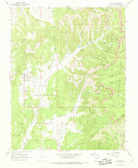
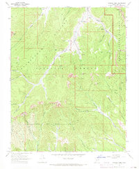
 1966 Cannonville1968 Print · USGSTropic and Cannonville are captured in the mid-1960s as they transition from isolated frontier outposts to gateways for the canyon country. Genealogists and researchers can locate family sites like Georgetown, the Bryce Valley Sch, and a remote Mine near the Paria River.3 unique versions available
 - 1966 Map of Alton, 1968 Print
 1966 Alton1968 Print · USGSAlton and the surrounding high desert ranchlands are documented in the mid-sixties, before modern developments changed the local character. Genealogists and local historians can trace family sites like the Alton Cemetery and Swapp Ranch among the canyons of the Dixie National Forest.2 unique versions available
 - 1966 Map of Bald Knoll, 1968 Print
 1966 Bald Knoll1968 Print · USGSKane County in the late sixties reveals a network of springs and canyons vital to the high desert livestock economy. Researchers can locate remote landmarks like Bald Knoll, the named waters of Spaniard Spring, and early resource extraction sites including several Mines.2 unique versions available
 - 1966 Map of Deer Spring Point, 1968 Print
 1966 Deer Spring Point1968 Print · USGSKane County's high plateau country is captured here in the mid-1960s, showing a remote landscape of ranching and desert trails. Researchers can trace the layout of Findlay Ranch or locate old water sources like Sand Spring and Adams Springs.
 - 1966 Map of George Mtn, 1968 Print
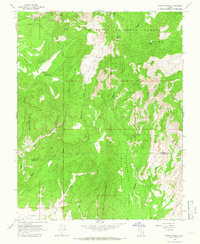
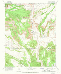
 1966 George Mtn1968 Print · USGSGarfield and Kane counties meet in this high-altitude landscape during the 1960s, where the Sevier River valley transitions into the national forest. Researchers can trace historic access routes via Jeep Trails and Pack Trails to landmarks like George Mtn and Panguitch Fish Hatchery.
 - 1966 Map of Deer Range Point, 1968 Print
 1966 Deer Range Point1968 Print · USGSKane County's high desert landscape comes alive in the mid-1960s, showing the remote ranching and geological character of southern Utah. Trace the isolation of Nipple Ranch and find unique landmarks like Mollies Nipple and No Mans Mesa.
 - 1966 Map of Podunk Creek, 1968 Print
 1966 Podunk Creek1968 Print · USGSThe high plateau country of southern Utah is captured here in the mid-1960s at the intersection of national forest and park lands. Researchers can trace remote backcountry outposts like the Podunk Guard Station and high-altitude crossings such as Yovimpa Pass and Crawford Pass.3 unique versions available
 - 1966 Map of Skutumpah Creek, 1968 Print
 1966 Skutumpah Creek1968 Print · USGSKane County's high-desert backcountry is captured here in the mid-1960s, showing a landscape defined by stock trails and remote springs. You can trace early routes like the Old Corral Trail or locate family-named landmarks such as Carly Knoll and Jodys Knoll.2 unique versions available
 - 1966 Map of Rainbow Point, 1969 Print
 1966 Rainbow Point1969 Print · USGSThe high plateau of Kane County meets a maze of canyons in the 1960s, just as the regional ranching and forest landscape remained largely primitive. Researchers can locate isolated outposts like Swallow Park Ranch or trace the early Pack Horse Trail and Jeep Trails near Rainbow Point.
 - 1966 Map of Tropic Reservoir, 1969 Print
 1966 Tropic Reservoir1969 Print · USGSThe high plateau of southern Utah in the 1960s is mapped here in detail, showing a wilderness of early trails and forest management. Researchers can trace the Proctor Pack Trail and locate landmarks like Natural Bridge and King Creek Campground.2 unique versions available
 - 1966 Map of Bryce Point, 1969 Print
 1966 Bryce Point1969 Print · USGSHigh desert plateaus and limestone spires meet in Garfield and Kane Counties during the mid-1960s. Trace the early ranching history at the Johnson Ranch (Site) and explore geological landmarks like the Silent City, Hat Shop, and Natural Arch.2 unique versions available
 - 1968 Map of Fourmile Bench, 1970 Print
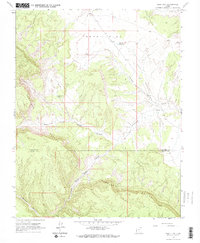
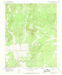
 1968 Fourmile Bench1970 Print · USGSThe high plateau of Kane County is captured in the late sixties, showcasing the remote ranching and grazing lands of Fourmile Bench. Researchers can trace the network of Jeep Trails and family-named landmarks like Tommy Smith Creek and the isolated Landing Strip.3 unique versions available
Showing maps 1-25 of 36
Top cities of Kane County
- Kanab historical maps
- Orderville historical maps
- Big Water historical maps
- Glendale historical maps
- Alton historical maps
Frequently asked questions
- What are the different types of historical maps available for Kane County?
- What is the oldest map of Kane County?
- Where can I purchase historical maps of Kane County for my home or office?
- Where can I download high-res historical maps of Kane County?
- Are there historical topographic maps available for Kane County?
- Is there historical aerial imagery available for Kane County?
- Where are historical maps of Kane County sourced from?