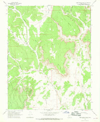
1966 Map of Deer Spring Point
USGS Topo · Published 1968About this map
The White Cliffs dominate this mid-century topographic record, where the high desert terrain of Kane County transitions into dramatic plateaus and deep drainage basins. Centered on Deer Spring Point, the map reveals a landscape defined by livestock grazing and seasonal water sources, featuring Nephi Pasture and isolated water points like Adams Springs and Sand Spring. Human activity is sparse, concentrated at the Findlay Ranch and along a network of primitive tracks marked as Jeep Trail.
Find a feature on this map
30 named features on this map. Tap any name to fly to it.
Don’t see what you’re looking for? This feature index may not catch every label — zoom into the map to look around manually.
Map Details
Editions of this 1966 Deer Spring Point Map
This is the sole edition of this map. No revisions or reprints were ever made.
Other maps of this area

1886 · Kanab
USGS Topo · 1:250,000

1953 · Cedar City
USGS Topo · 1:250,000

1954 · Buckskin Gulch NW
USGS Topo · 1:24,000

1954 · Buckskin Gulch NE
USGS Topo · 1:24,000

1954 · Johnson NE
USGS Topo · 1:24,000

1954 · Buckskin Gulch
USGS Topo · 1:62,500

1954 · Johnson
USGS Topo · 1:62,500

1958 · Cedar City
USGS Topo · 1:250,000

1962 · Cedar City
USGS Topo · 1:250,000
1966 · Bull Valley Gorge
USGS Topo · 1:24,000