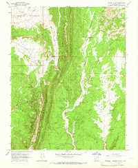
1964 Map of Butler Valley
USGS Topo · Published 1966About this map
Grosvenor Arch stands as a prominent geological landmark in this mid-1960s survey of southern Utah’s high desert. The landscape is dominated by the dramatic uplift of The Cockscomb, a jagged ridge that divides the drainage of Cottonwood Creek and Wahweap Creek. Along the eastern edge of this formation, the narrow passage known as The Gut illustrates the complex erosion patterns of the area. Human presence is sparse, represented by a network of jeep trails connecting isolated points of interest such as the Headquarters Cabin and nearby Headquarters Springs.
Find a feature on this map
23 named features on this map. Tap any name to fly to it.
Don’t see what you’re looking for? This feature index may not catch every label — zoom into the map to look around manually.
Map Details
Editions of this 1964 Butler Valley Map
2 editions found
Other maps of this area

1886 · Escalante
USGS Topo · 1:250,000

1922 · Upper Last Chance
USGS Topo · 1:63,360

1955 · The Cockscob SW
USGS Topo · 1:24,000

1956 · Escalante
USGS Topo · 1:250,000

1960 · Escalante
USGS Topo · 1:250,000

1964 · Horse Flat
USGS Topo · 1:24,000

1964 · Canaan Peak
USGS Topo · 1:24,000

1964 · Death Ridge
USGS Topo · 1:24,000

1964 · Henrieville
USGS Topo · 1:24,000
1964 · Calico Peak
USGS Topo · 1:24,000