
1964 Map of Death Ridge
USGS Topo · Published 1966About this map
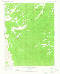
Death Ridge anchors this 1964 survey of the high plateau country along the boundary of Garfield and Kane counties. The landscape is defined by an intricate network of drainage systems, where the headwaters of Escalante Canyon and Paradise Canyon carve into the south, while Little Valley Wash and Alvey Wash drain the northern slopes. This era of land management is reflected in the corner of Dixie National Forest and the development of water resources like the Death Ridge Reservoir. The map reveals a world of isolated named points such as Lonesome Pine Flat and Mossy Dell, and essential water sources for cattle or travelers like Horse Spring, Star Seep, and Camp Spring. Navigating the deep incisions of Right Hand Collet Canyon and Trap Canyon, the topography shows a region transitioned from wild territory to surveyed public land with established unimproved roads.
Find a feature on this map
17 named features on this map. Tap any name to fly to it.
Don’t see what you’re looking for? This feature index may not catch every label — zoom into the map to look around manually.
Map Details
Editions of this 1964 Death Ridge Map
2 editions found
Other maps of this area

1886 · Escalante
USGS Topo · 1:250,000

1922 · Upper Last Chance
USGS Topo · 1:63,360

1956 · Escalante
USGS Topo · 1:250,000

1960 · Escalante
USGS Topo · 1:250,000

1964 · Dave Canyon
USGS Topo · 1:24,000

1964 · Canaan Creek
USGS Topo · 1:24,000

1964 · Canaan Peak
USGS Topo · 1:24,000

1964 · Carcass Canyon
USGS Topo · 1:24,000
1964 · Butler Valley
USGS Topo · 1:24,000
1964 · Upper Valley
USGS Topo · 1:24,000