
1964 Map of Dave Canyon
USGS Topo · Published 1966About this map
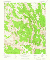
The Straight Cliffs dominate this mid-century topographic study, forming a massive, linear escarpment that dictates the hydrology and travel patterns across this portion of Garfield County. To the east of this significant rise, the landscape is defined by a network of drainage systems, including the notable Alvey Wash and Cottonwood Wash. These desert watercourses, while often ephemeral, are the primary markers in an otherwise high-plateau environment. The 1964 field check reveals a remote territory with minimal human infrastructure, save for a solitary Jeep Trail that picks its way through the northeastern terrain. Water sources such as Oak Spring and Rock Spring are critical landmarks in this arid region, providing essential points of reference for those navigating the canyons. Steep-walled recesses like Dave Canyon, Bull Run Canyon, and Calf Canyon cut deeply into the plateau, illustrating the severe erosion characteristic of the area's geography.
Find a feature on this map
12 named features on this map. Tap any name to fly to it.
Don’t see what you’re looking for? This feature index may not catch every label — zoom into the map to look around manually.
Map Details
Editions of this 1964 Dave Canyon Map
This is the sole edition of this map. No revisions or reprints were ever made.
Other maps of this area

1886 · Escalante
USGS Topo · 1:250,000

1956 · Escalante
USGS Topo · 1:250,000

1960 · Escalante
USGS Topo · 1:250,000

1964 · Tenmile Flat
USGS Topo · 1:24,000
1964 · Calf Creek
USGS Topo · 1:24,000

1964 · Canaan Creek
USGS Topo · 1:24,000

1964 · Seep Flat
USGS Topo · 1:24,000

1964 · Death Ridge
USGS Topo · 1:24,000

1964 · Carcass Canyon
USGS Topo · 1:24,000
1964 · Wide Hollow Reservoir
USGS Topo · 1:24,000