
1964 Map of Canaan Creek
USGS Topo · Published 1966About this map
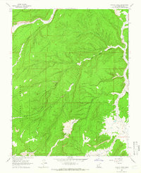
Dixie National Forest covers much of this high-plateau landscape, where drainage patterns define the rugged topography of Garfield County. In the mid-1960s, the area's economic activity was largely driven by natural resource exploration, as evidenced by a labeled Oil Well in the west and several Prospects along the eastern edge near Alvey Wash. The intricate network of canyons, including Mitchell Canyon and Coal Bed Canyon, shows how water has carved the terrain over time. Central to the map is the confluence of high-altitude valleys and creek systems, with Canaan Creek and Willow Creek cutting through the center while the broader Upper Valley and Upper Valley Creek dominate the northwest. This survey is particularly useful for those tracing early mid-century resource extraction points and the established trail system, such as the Jeep Trail winding through the eastern wash.
Find a feature on this map
21 named features on this map. Tap any name to fly to it.
Don’t see what you’re looking for? This feature index may not catch every label — zoom into the map to look around manually.
Map Details
Editions of this 1964 Canaan Creek Map
2 editions found
Other maps of this area

1886 · Escalante
USGS Topo · 1:250,000

1956 · Escalante
USGS Topo · 1:250,000

1960 · Escalante
USGS Topo · 1:250,000

1964 · Griffin Point
USGS Topo · 1:24,000

1964 · Dave Canyon
USGS Topo · 1:24,000

1964 · Canaan Peak
USGS Topo · 1:24,000

1964 · Death Ridge
USGS Topo · 1:24,000

1964 · Carcass Canyon
USGS Topo · 1:24,000
1964 · Wide Hollow Reservoir
USGS Topo · 1:24,000
1964 · Upper Valley
USGS Topo · 1:24,000