
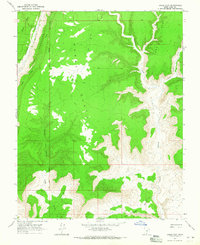
1964 Map of Horse Flat
USGS Topo · Published 1965About this map
Horse Flat dominates this high-desert plateau in Kane County, Utah, where complex drainage systems and abrupt geological shifts define the landscape. The western edge is sharply bounded by The Cockscomb, a dramatic hogback ridge that funnels seasonal water into Cottonwood Creek and Rush Creek. The map documents a primitive transportation network, primarily consisting of a Jeep Trail that traverses the central flats, connecting the high country to the deeply incised Coyote Canyon and Long Canyon systems. These canyons eventually drain into the broad wash of Wahweap Creek, which carves through the southeast corner of the quadrangle. The inclusion of the Salt Lake Meridian provides a key surveying anchor, illustrating how early land divisions were imposed upon this intricate terrain of benches and crotches, such as Jack Riggs Bench and the curiously named Cads Crotch.
Find a feature on this map
13 named features on this map. Tap any name to fly to it.
Don’t see what you’re looking for? This feature index may not catch every label — zoom into the map to look around manually.
Map Details
Editions of this 1964 Horse Flat Map
2 editions found
Other maps of this area

1886 · Escalante
USGS Topo · 1:250,000

1922 · Upper Last Chance
USGS Topo · 1:63,360

1953 · Nipple Butte
USGS Topo · 1:62,500

1954 · Paria NW
USGS Topo · 1:24,000

1954 · Paria
USGS Topo · 1:62,500

1955 · The Cockscob SW
USGS Topo · 1:24,000

1956 · Escalante
USGS Topo · 1:250,000

1960 · Escalante
USGS Topo · 1:250,000
1964 · Calico Peak
USGS Topo · 1:24,000
1964 · Butler Valley
USGS Topo · 1:24,000