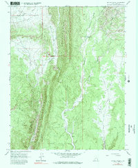
1964 Map of Butler Valley
USGS Topo · Published 1980About this map
The Cockscomb dominates this central Kane County landscape, forming a sharp tectonic spine that separates the broad Horse Flat and Long Flat from the western drainage of Butler Valley. This mid-century survey reveals a remote ranching and grazing environment where water sources like Headquarters Springs and Wahweap Creek dictated the location of human activity. Notable landmarks such as the Grosvenor Arch and distinctive topographical features like The Gut and Cads Crotch indicate a land shaped by dramatic erosion.
Find a feature on this map
26 named features on this map. Tap any name to fly to it.
Don’t see what you’re looking for? This feature index may not catch every label — zoom into the map to look around manually.
Map Details
Editions of this 1964 Butler Valley Map
2 editions found
Other maps of this area

1886 · Escalante
USGS Topo · 1:250,000

1922 · Upper Last Chance
USGS Topo · 1:63,360

1955 · The Cockscob SW
USGS Topo · 1:24,000

1956 · Escalante
USGS Topo · 1:250,000

1960 · Escalante
USGS Topo · 1:250,000

1964 · Horse Flat
USGS Topo · 1:24,000

1964 · Canaan Peak
USGS Topo · 1:24,000

1964 · Death Ridge
USGS Topo · 1:24,000

1964 · Henrieville
USGS Topo · 1:24,000
1964 · Calico Peak
USGS Topo · 1:24,000