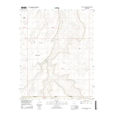
2014 Map of Deep Canyon South
USGS Topo · Published 2014About this map
Navajo Mountain dominates this portion of the borderlands between Arizona and Utah, marking a landscape of deep drainages and high plateaus. The terrain is defined by the massive carving of Piute Canyon, through which Piute Cr flows toward the north. To the west, the Rainbow Plateau and Deep Canyon showcase the characteristic geological layering of the region, while the Hawkeye Natural Bridge stands as a distinct landmark in the northwest corner. This area reflects a traditional navigation network where paths like Piute Canyon Rd and the trail simply labeled Jack Rabbit follow the natural contours of the land. The presence of Jackrabbit Canyon and its associated Jackrabbit Fork further illustrates the complex hydrological systems that have shaped this high-desert environment over millennia.
Find a feature on this map
20 named features on this map. Tap any name to fly to it.
Don’t see what you’re looking for? This feature index may not catch every label — zoom into the map to look around manually.
Map Details
Editions of this 2014 Deep Canyon South Map
This is the sole edition of this map. No revisions or reprints were ever made.
Other maps of this area

1883 · Marsh Pass
USGS Topo · 1:250,000

1886 · Henry Mountains
USGS Topo · 1:250,000

1892 · Marsh Pass
USGS Topo · 1:250,000

1892 · Henry Mountains
USGS Topo · 1:250,000

1952 · Shato Spring 1 NE
USGS Topo · 1:24,000

1952 · Navajo Mtn. 4 SE
USGS Topo · 1:24,000

1952 · Navajo Mountain 4 NE
USGS Topo · 1:24,000

1953 · Navajo Mountain 4 NW
USGS Topo · 1:24,000

1953 · Navajo Mountain 4 SW
USGS Topo · 1:24,000

1953 · Navajo Mountain
USGS Topo · 1:62,500