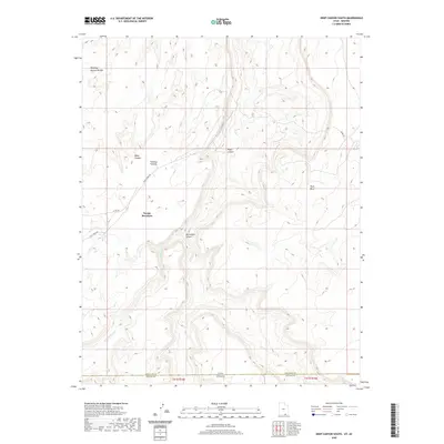
2020 Map of Deep Canyon South
USGS Topo · Published 2020About this map
Hawkeye Natural Bridge stands as a prominent landmark in this high-desert landscape where the Utah-Arizona state line meets the boundary of San Juan and Navajo Counties. This 2020 survey details the complex drainage patterns of Piute Canyon and Jackrabbit Canyon, which carve through the Rainbow Plateau. The presence of Piute Cr and Jackrabbit Fork illustrates the erosional forces that have shaped the surrounding Piute Mesa and the slopes of Navajo Mountain. While largely a study of elevation and natural features, the inclusion of Piute Creek Rd and Co Rd 434 provides a sense of modern accessibility into these remote basins, including the namesake Deep Canyon.
Find a feature on this map
15 named features on this map. Tap any name to fly to it.
Don’t see what you’re looking for? This feature index may not catch every label — zoom into the map to look around manually.
Map Details
Editions of this 2020 Deep Canyon South Map
This is the sole edition of this map. No revisions or reprints were ever made.
Other maps of this area

1883 · Marsh Pass
USGS Topo · 1:250,000

1886 · Henry Mountains
USGS Topo · 1:250,000

1892 · Marsh Pass
USGS Topo · 1:250,000

1892 · Henry Mountains
USGS Topo · 1:250,000

1952 · Shato Spring 1 NE
USGS Topo · 1:24,000

1952 · Navajo Mtn. 4 SE
USGS Topo · 1:24,000

1952 · Navajo Mountain 4 NE
USGS Topo · 1:24,000

1953 · Navajo Mountain 4 NW
USGS Topo · 1:24,000

1953 · Navajo Mountain 4 SW
USGS Topo · 1:24,000

1953 · Navajo Mountain
USGS Topo · 1:62,500