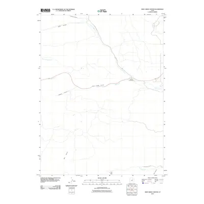
2011 Map of Deep Creek Canyon
USGS Topo · Published 2011About this map
Deep Creek Canyon defines the central geography of this Wasatch County landscape, where the waters of Deep Creek and the North Fork Deep Creek converge. The terrain is marked by a complex system of drainages, including Wildcat Canyon, Beaver Canyon, and Slab Canyon, which channel seasonal runoff toward the southern boundary.
Find a feature on this map
14 named features on this map. Tap any name to fly to it.
Don’t see what you’re looking for? This feature index may not catch every label — zoom into the map to look around manually.
Map Details
Editions of this 2011 Deep Creek Canyon Map
This is the sole edition of this map. No revisions or reprints were ever made.
Other maps of this area

1885 · Salt Lake
USGS Topo · 1:250,000

1885 · Uinta
USGS Topo · 1:250,000

1907 · Strawberry Valley
USGS Topo · 1:125,000

1909 · Strawberry Valley
USGS Topo · 1:125,000

1954 · Salt Lake City
USGS Topo · 1:250,000

1958 · Salt Lake City
USGS Topo · 1:250,000

1960 · Salt Lake City
USGS Topo · 1:250,000

1962 · Deep Creek Canyon
USGS Topo · 1:24,000

1962 · Fruitland
USGS Topo · 1:24,000

1962 · Raspberry Knoll
USGS Topo · 1:24,000